
San Diego Grand Tour 2023
April

The sunset view from atop Corte Madera Peak.
Are you interested in using maps and existing trails to create longer trips of your own?
Alpine Adventure Coaching is a time-tested and trail-proven program to empower future long distance backpackers with the critical skills and confidence to plan, prepare, and safely complete a journey filled with diverse outdoor challenges on the when circumnavigating the Yosemite Valley Rim.
A Google Earth tour of Day 1.
From the beginning we had grand plans. It was January and the Winter had been colossal as we were beginning to make plans for a Spring Break trip. Our best guess was that, as with most every year, Winter would start to fade away by April and Spring would provide the perfect conditions for an early season snow route from Highway 80 to Highway 50 along the Pacific Crest Trail. I’d hiked this section many times before but never in full snow and was excited about the opportunity to learn about new gear and techniques involved in multi-day snow travel. We’d done a training trip to Dewey Point in Yosemite in January and were gearing up for a 3/31 start at Donner Pass.
As February moved into March and Winter wasn’t seeming to slow down, we decided we should build in a back-up plan just in case the weather window somehow decided not to cooperate the first week of April. We were doubtful that would happen, but we wanted to make sure we were on the trail and not sitting at home. Our first thought was the Grand Canyon. I’d always wanted to try the rim-to-rim-to-rim and Spring Break seemed like a perfect time for an attempt. The more we talked and researched, the more neither one of us wanted to be stuck in a car for 13 or 14 hours. We tabled the idea. Next, I reached out to my good friend Derek in Southern CA to pick his brain. Derek is the creator of 100 Peaks at 100peaks.com and has a plethora of information on all outdoor opportunities in and around San Diego County. As I’d predicted, he was immediately intrigued. Going back and forth over both text and email for just a few days, he had built numerous possibilities in the Cleveland National Forest just an hour from his home. In the end, we decided on a route he’d created that he’d called the South San Diego Grand Tour v.3 (or SSD GT V3). On the map he’d built in CalTopo, a concession he’d made for me since he and most of my other friends use Gaia Topo to plan trips, the loop/lollipop measured out to 72.22 miles. It was the perfect length for a 5 day trek. It was perfect for a future trip as we still truly believed that Winter would turn to Spring allowing us to tackle the snow covered 80 to 50 route. We were as wrong as wrong can be.
A couple weeks before the trip, the weather patterns still showed one atmospheric river after another predicted to barrel through the mountains. It was time to switch gears. It was time to plan to head south. We looked into flights but the times and prices were much too constricting for our comfort level. We decided that driving to San Diego would give us more flexibility. In the end, the Sierras would get another 5 feet of snow during the days we’d planned on hiking. We’d made the right decision.
We left on Thursday, 3/31 and drove just over 8 hours directly to Escondido and we settled into Burger Bench, Derek’s restaurant. I’d been a couple times before and had wanted to return ever since. The amazing staff and Derek himself set us up with local beer and amazing food all created in house. Derek has created a place that showcases his local area in both food and beer. It’s a wonderful atmosphere, staffed by friendly and skilled employees and featuring both amazing food and wonderful beer. Derek, his partner and their family have truly created something special. I only wish I lived closer to visit more often.
We spent the night at his house with his wonderful family in the hills above San Diego talking and visiting into the late hours of the night. I’d awoken at my normal time of 4:30 am that morning and was asleep just after midnight. Pablo and I had talked constantly for 8+ hours in the car, talked with Derek non stop at the restaurant and then talked more with Derek and his wife Hoa into the late hours of the night. I was completely spent. I hadn’t walked a single mile yet.
Day 1
Daily Miles -16.69
Daily Elevation Gained - 2956 ft
Daily Elevation Lost - 1834 ft
Total Miles - 16.69
We were up and out of the house about 8am and driving. We stopped in the town of Alpine for a much bigger breakfast than I’m used to before a hike. It would fuel me for most of the first day. The drive was beautiful with Derek sharing the names of peaks, towns, and areas all along the way. Before we knew it, we were there at the Espinosa Trailhead. We took a few pictures, said our goodbyes, and headed off. I’m not sure who was more excited - Pablo and me about the miles to come, or Derek knowing that he’d researched and created a route for his buddies to hike as well as to gather beta so that he could someday attempt it.
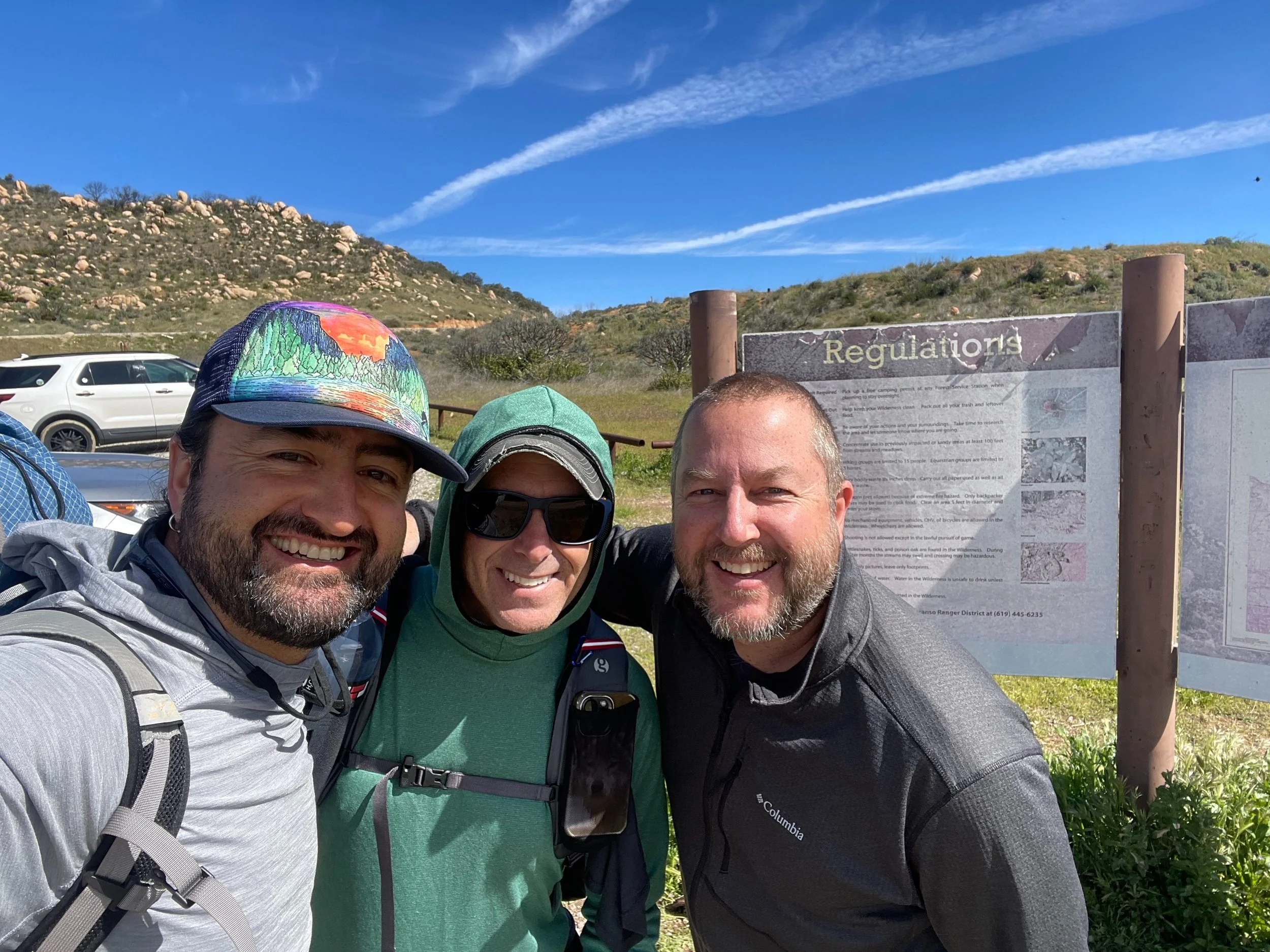
Pablo, Adam and our good friend and trip creator, Derek.
A cool wind blew which took the edge off of the hot sun. It was a warm, but not hot, morning. We ascended a bit through the chaparral before starting a big drop leading us to the just over 1500 ft of trail that we would hike on twice. Derek knows my love of loops and worked hard to make sure we didn’t have to retrace our steps on this route any more than possible.
When building the map, Derek had built in places to get water, even listing places that we should “load up” because sources would probably be limited over the coming miles. We all knew that this area, like the rest of the state, had received a lot more rain and snow than normal. I’d elected to bring some light weight water crossing shoes because I’d predicted that we’d have enough to warrant the weight. I’d made the right decision for sure!
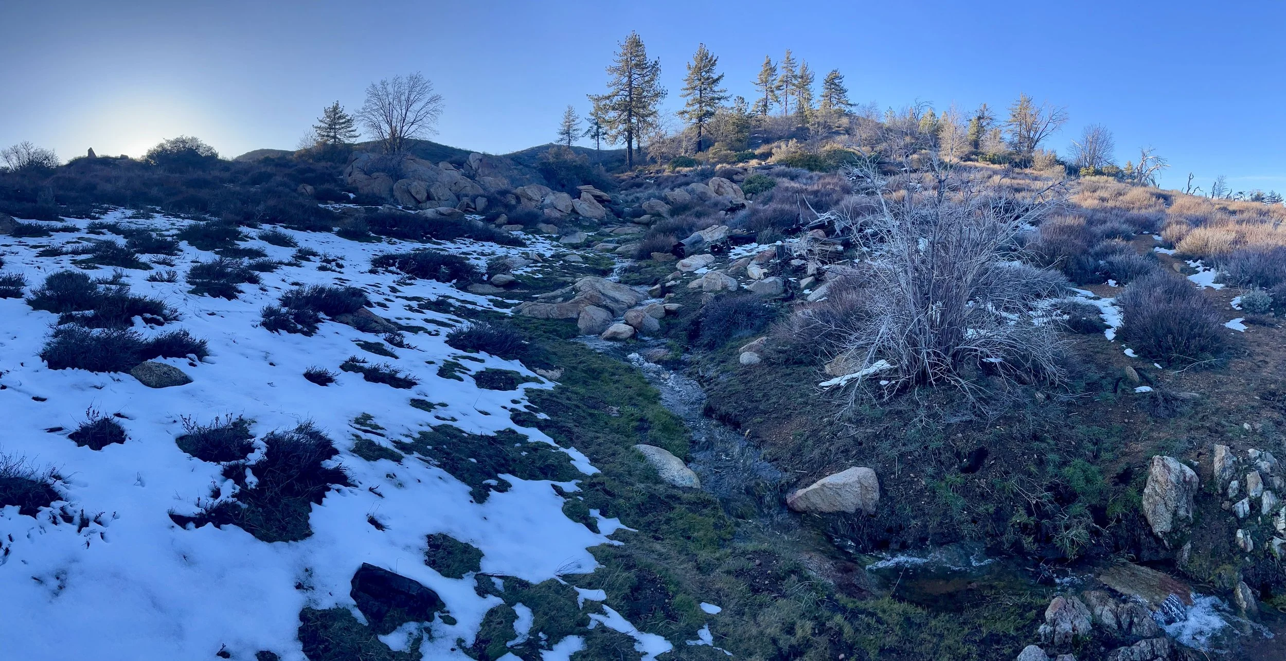
Entering the wilderness.
Pine Valley Creek was just 1.7 miles into our hike. It flows out of Horsethief Falls. A place frequented in the summer months by those that want to relax and play in its gentle pools. There was nothing gentle about this place. Roaring, brown muddy water rushed from the canyon above and over/through multiple small waterfalls. What came out of the bottom was a rapid-filled, brown and muddy fast moving “creek” where the trail ended and then continued on the other side. We decided to venture a couple hundred yards downstream to find a better crossing. Nothing. Only bigger rapids. We did the same upstream and found a more narrow section of creek but with a far bank choked so tight with sticker bushes that we’d have to spend an enormous amount of time and energy getting back downstream to the trail. Our only choice was to cross back at the trail.
Pablo crossing Pine Creek for our first time.
We took off not only our shoes, but our pants as well. Not knowing how deep the water would be, we didn’t want to take the chance of having wet pants for the rest of the day. Our gear was protected because our packs had garbage bags inside as a water barrier.
I went first on this one and about halfway across felt not only the power of the water but stopped myself as I felt a very deep hole with my trekking poles in front of me. Moving through water this powerful with zero visibility, it’s critical to keep 3 points of contact at all times and to move slowly, carefully, and deliberately. Feeling the dropoff I moved to my left and took a completely different route to the other side than I’d planned. With the information I’d gained in my crossing, Pablo took the same line and we both crossed without incident. Between the pre-cross scouting, undressing, crossing and redressing, we’d been at this creek for about 45 minutes. I was grateful I’d brought the extra shoes to cross. This confirmed my suspicions that we were going to encounter a ton of water on this adventure.
After our crossing, we finished the last of the 1500 ft section of trail we would see again in 5 more days and headed off into Secret Canyon. We paralleled a small tributary for a while before having to re-cross Pine Valley Creek once more. And only 1.75 miles later would need to cross Nelson Creek. These two crossings got progressively harder and a bit more scary for both of us. In Nelson, Pablo, who is quite a bit taller than I am, sank significantly past his hipbelt where his pack was submerged about a foot into the water. I spent extra time finding a different route that kept my waist just barely above the waterline. Both of these crossings took about 30 minutes to scout, undress, cross and re-dress.
Secret Canyon in all it’s glory.
Secret Canyon was beautiful. The higher we got, the cooler the air became. We were introduced to flowering Yucca. What an amazing plant. We would see these throughout our days at lower elevations. Some were tiny, others were large with an amazing flowering stalk. Still others were dried up and dead. This amazing plant lives for about 8 years and in its last 2-3 years puts all of its energy into creating a 3-4 foot beautiful flower stalk. Once the flower fully blooms, the entire plant dies. They were everywhere in this area.
Yucca in full bloom!
As we continued, we would enter and exit completely different biomes moving in and out of chaparral and coastal sage scrub plant communities. We continued up this canyon moving in and out of California Buckwheat, Toyon with its red berries, fragrant Coastal Sagebrush, Laurel Sumac, Lemonade Berry also with red berries, Black Sage not yet in bloom with last years’ dead brown flower sticks and California Live Oak trees. It was spectacular.
Finally, we reached the Old Flume Grade. It’s named after a wooden flume that was built in 1895 to that was intended to divert water from a reservoir in Pine Valley to King Creek, a tributary of the San Diego River, and then on to the growing San Diego metropolis. Never completed, sections of the remaining stone flume were used in 1992 to construct the Secret Canyon Trail.
The Old Flume Trail.
The Old Flume Grade trail follows the route of the old flume for about 5 miles over about a 1200 foot climb and gave us amazing views of the surrounding mountains and canyons. The intricate rock wall of the flume still exists in many places on this section.
This was the section where an enormous S-2 Tracker plane was practicing dropping into our canyon. It repeated its route 10-12 times over the course of an hour dropping into the canyon just under the flume. A close friend of mine explained that the plane is an old Navy carrier based anti submarine patrol plane retrofitted with powerful turboprops for firefighting. Each and every time we had to stop to take pictures and videos. I felt like a little boy in awe each time it circled in.
Enormous S-2 Tracker
The day was growing long and we were getting more tired as the hours passed. The first day on a trail is always tough as the legs, feet, and muscles start to remember what this hiking thing is all about. At about 5 pm we finally reached the enormous Highway 8 bridge over the Pine Valley Creek. We’d have to cross this river one more time for the day before setting up camp another mile further. We were tired and the creek was no less powerful than down below. It took a while to find the right route and even more time to dry off and re-dress after the crossing. This was made even more intense when looking around at the various items that had come down from above over the years. The last thing I wanted was a fender dropping 150 feet from the roadway down on top of us. Although this bridge had had a lot of renovations recently, it was built in 1974 to replace a bridge built in the 1920s. The bridge rises about 1450 feet above Pine Valley Creek that we were currently crossing.
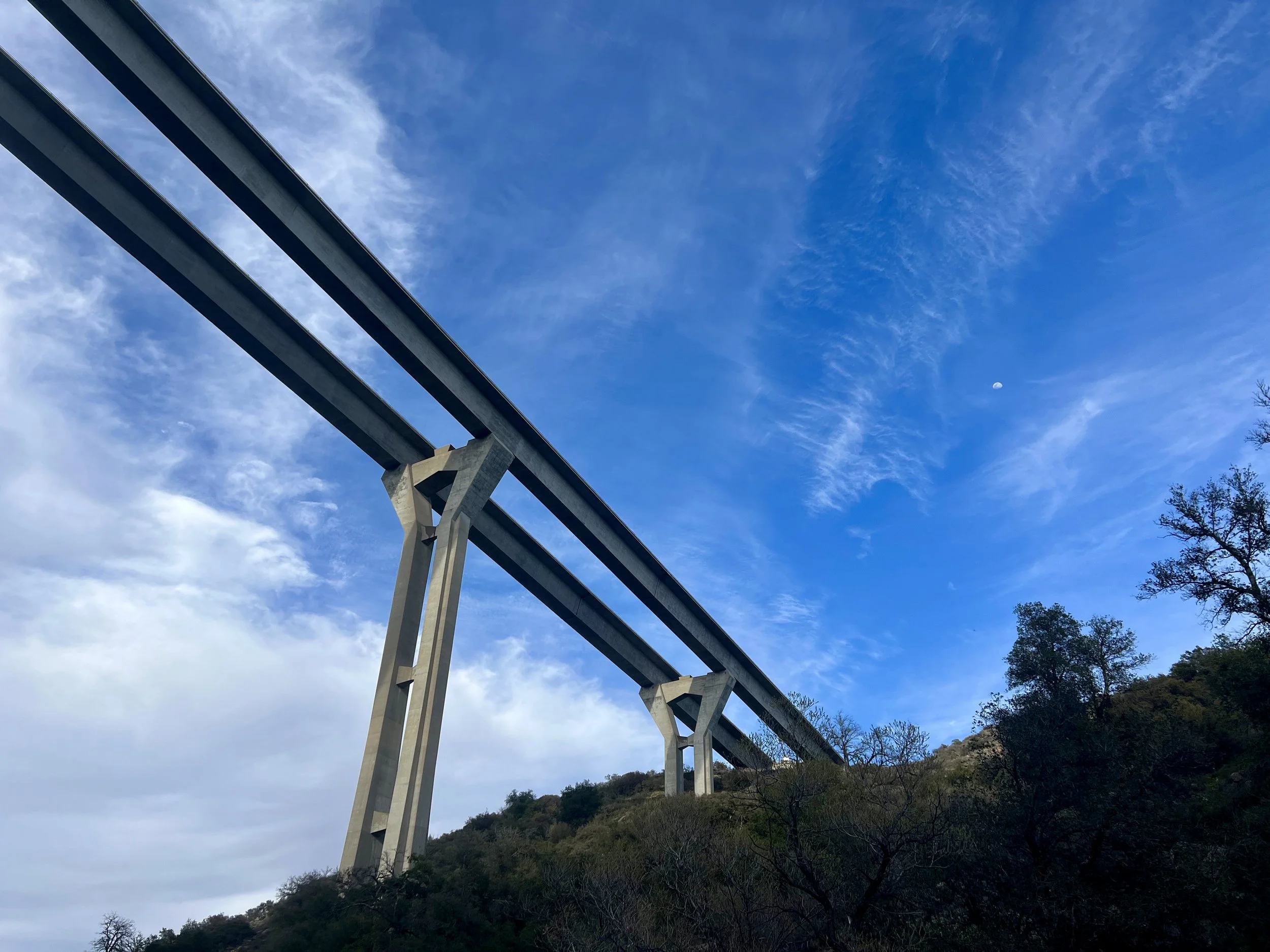
Highway 8 bridge.
Once across, Pablo looked back and pointed out a mangled car on the other side of the creek and under the bridge. We had walked just below it but never noticed it before crossing. Pablo looked the crash up after the hike and found that it happened back in 2016 and that the driver was killed.
A mile later we had reached the area we had planned to camp. It was soaking wet and we spent another hour looking for a better spot. As darkness took over, we settled for a spot just off the trail and just above the creek. The roaring noise of the creek helped hide any of the freeway noise from the bridge. We made dinner by headlight and got ready for sleep. Even before laying down we could see and feel the dampness over everything. This would be a very wet night.
Camp setup timelapse.
Day 2
Daily Miles -18.14 miles
Daily Elevation Gained- 4255 ft
Daily Elevation Lost - 2231 ft
Total Miles - 34.83 miles
A Google Earth tour of Day 2.
We woke up to ice. Lots and lots of ice. Ice covering the ground, the grass and the trees. Ice covering Pablo’s tent and covering my bivy. And since we were deep in a canyon, there was no sun. We had a quick breakfast and packed up our icy gear. We knew we would be stopping to dry things out later in the day. This was critical, as my sleeping bag was quite wet. I’d decided not to set up my tarp but only my bivy and because of this the dew had covered my bivy and thus my sleeping bag. It was a wet, icy mess.
Icy morning.
A mile into our walk out of camp we had to spend the time scouting, changing, crossing Pine Valley Creek and then changing again before moving on. Right out of the crossing was a trailhead with a couple day hikers and some kayakers getting ready for a ride. I can’t imagine there are very many years there's been enough water in that creek to kayak. This was not a normal year.
Adam crossing Pine Valley Creek. Again.
Still warming up, we kept walking and hit the paved road. We’d walk a bit over a mile on the asphalt and all uphill. Finally, we followed a gap in the fence to the south and headed in on an old dirt road and into Wild Pigeon Flat. It was spectacular. Green grasses, shrubs and Oak trees. Wild Pigeon Flat is a historic site originally settled by the Kumeyaay Native American nation, who used the site for hunting and gathering.
Pigeon Flats
In terms of man made construction, we saw only a lone noisy old windmill. The rest of the area was all nature. As we skirted the Cuyamaca State Park boundary, we started the only “off trail” section of our route and it was a doozy. A distance of only 2.25 miles took us over two hours to cross. We were going uphill in shoulder high chaparral and manzanita forever. With every step forward it was a battle to push through the thick unforgiving branches wanting to hold us back. (Later in the trip I’d found out that Derek had predicted we’d either hug him or punch him” after the trip. Of the 86+ miles we would hike, this two mile section was the only that made me want to punch. The other 84 miles were all nothing but hugs.)
Pablo bushwhacking.
We finally came out of the bushwack and into a low and very wet area. This was quite near an old Cabin Derek had listed on the map. We knew we were close, but after our bushwack battle and now this ankle high wet mud, we decided to forgo finding the cabin and to instead find the road we were supposed to connect with. As we made our way through the boggy area we began to hear voices of others on the road. As we got closer we could even see flashes of color from the three people walking. But no matter what route we tried, the last 30 yards proved to be difficult and painful. The area was completely choked with brush. We finally found a line and committed. Just a few feet before the road, Pablo’s progress completely stopped as a thick branch pierced his shirt and held him in place. Pablo didn’t realize this and kept pushing forward until I let him know he’d be speared. He released the catch and I moved past it carefully as well. We were free and on a dirt road.
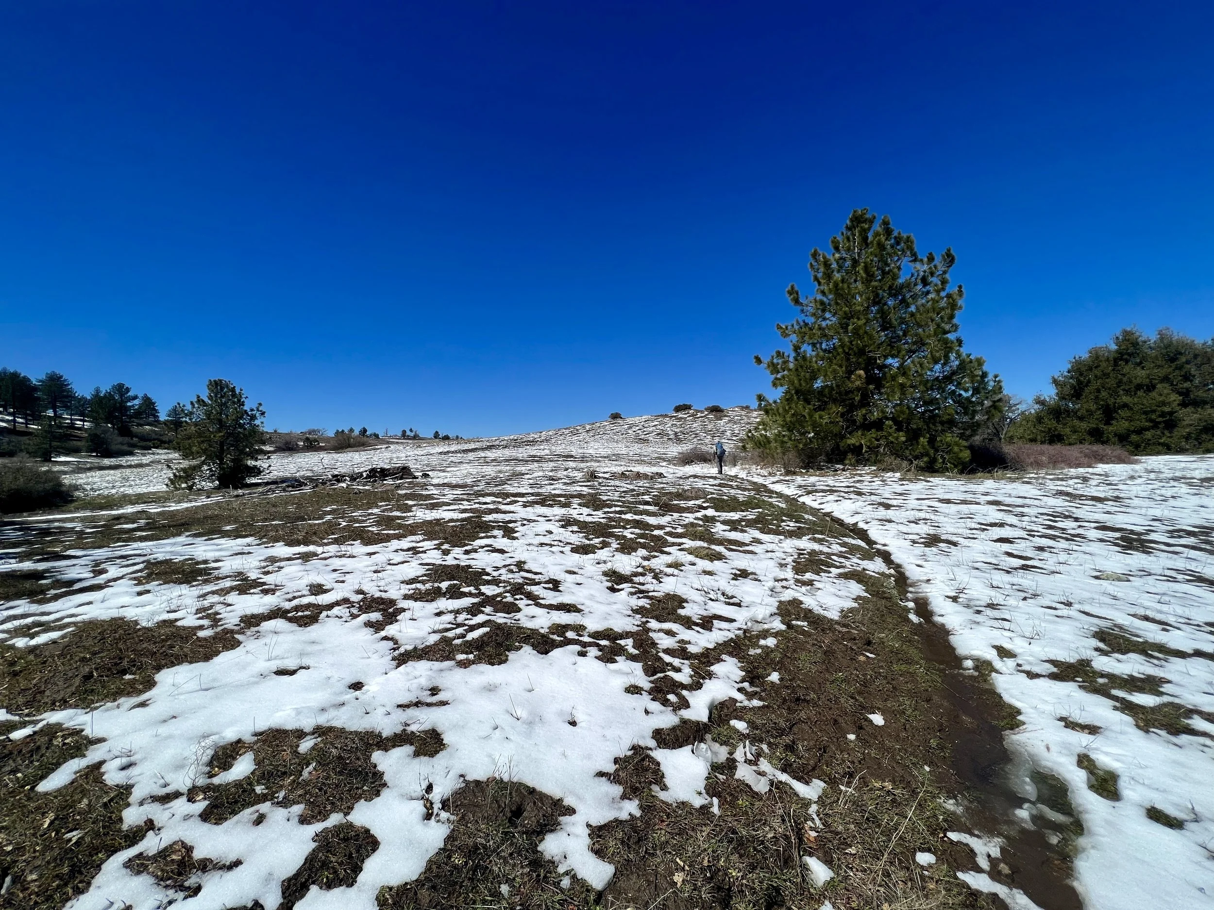
The next 4 miles were spectacular. The grasslands of Cuyamaca State Park are home to a rich diversity of plants. Some were present for us but some were under ankle deep snow. We saw hints of California Oatgrass and Purple Needlegrass but didn’t get the gift of the wildflowers this area is known for. It was still just too cold and wet. After climbing into and out of the grasslands (more snow than grass at an elevation of about 4900 feet) we crossed out of the state park and once again, across Pine Valley Creek, still with an unbelievable amount of water.
Cuyamaca State Park.
The next 3 miles were along the Indian Creek Trail and up and over Champagne Pass. We were pleased and quite surprised to find two brand new comfortable benches atop the pass. We agreed that every backpacking pass should have seats for a rest (and maybe a cooler with beer. :)
Benches atop Champagne Pass.
Dropping off the pass we reached the Indian Creek Campsite that Derek had listed for night two. It was beautifully perched above the creek. It was also surrounded on three sides by snow, between two creeks and soaking wet. We didn’t want a repeat of the night before so we decided to continue on. In our haste, we didn’t check the map, crossed Indian Creek and continued on the trail on the other side. It immediately began climbing and the snow got deeper with each step. Thirty minutes in we were surprised we hadn’t reached the next campsite plotted by Derek. Checking our map we realized our error. We were on the wrong trail. We would have to retrace our steps. We’d lost an hour of dwindling daylight.
Indian Creek Trail hiking away from planned campsite.
We hoofed it back to Indian Creek, crossed it once more and then found the correct trail. It was getting darker and colder and we realized we both needed water but in our frustration had neglected to pick it up in our second crossing of Indian Creek. We hiked on and uphill into the windy shadows of the late afternoon. In no time at all we reached another creek and got water. We continued on and about a mile before another road and found the next campsite Derek had listed. It was a bushwhack up an unnamed hill and it took us another 30 minutes to find a clearing big enough for each of us to sleep. We made dinner quickly in the dwindling light as the wind picked up. After dinner, I decided to break my site down and set back up with my tarp to help block the wind. We said our goodnights and headed off to sleep. It was a good call to set up my tarp.
We continued on and about a mile before another road and found the next campsite Derek had listed.
A Google Earth tour of Day 3.
Day 3
Daily Miles - 19.14 miles
Daily Elevation Gained - 2113 ft
Daily Elevation Lost - 2303 ft
Total Miles - 53.97 miles
The wind gusts hit us hard most of the night. We would hear the gust coming from far away and then they’d hit us with their power. The tarp really helped to buffer the strongest of the gusts.
As we were packing up I heard a sound behind me and turned around to find a day hiker. Since we were off any main trails and had ended so late the night before, we had never given it a second thought someone would hike up that early in the morning. We talked for a few minutes and then he continued on his way to the summit of this small peak. We finished packing up and hit the trail without eating.
Within ¾ of a mile we were at the road and at the Pioneer Mail Picnic Area with a pit toilet and picnic tables. We enjoyed both as well as the sunshine and made breakfast and coffee to get the blood flowing. When we were done we met with a Park Ranger who had just driven up. We spoke to a forest ranger for quite a while and he was thrilled with our route that led directly through areas that he was solely responsible for. It was a lot of fun to hear information about the flume we’d walked through and the indigenous in the area.
Pablo sets up for breakfast at Pioneer Mail Rest Area,
Joining the PCT for the first time on the trip.
After getting water from the creek below, we continued onto the Pacific Crest Trail. It was ironic that we’d planned to be on the 1200 mile stretch of the PCT and now were 51 miles from Mexico on this iconic trail. We started our SOBO (Southbound) traverse of the trail and it wasn’t long before we saw the first of many NOBO hikers we would see on our route. We dropped for about ½ a mile and then started to climb. As we rose we were rewarded with a view of the San Jacinto Mountains. This range, at just over 60 miles north of our point, rose above 10,000 feet and would be NOBO PCT hikers’ first real challenge. They were completely covered in snow and looked similar to the mountains in the southern Sierra Nevada range. My stomach sank as I thought of all of these inexperienced thru-hikers that were either already in or just days away from these monsters. Many, if not most of these hikers, have no experience walking in snow, using crampons or ice axes. I sent them hopeful and safe thoughts as I put their danger out of my mind. In no time at all we were at the cutoff to the 1.3 mile trail to the top of Garnet Peak at 5868 ft. This was a peak I really wanted to climb while researching the route. I knew that the top had a commanding view of the Anza Borrego Desert and beyond but also knew that in about a mile we’d get a very similar view from our trail. We spoke to some day hikers coming down. When they walked away I said to Pablo that we could either hike this peak OR stop at the Tavern on the trail later in the day but probably not both. As I said the words I already knew our answer and Pablo reinforced it with just one word; “tavern.”
We continued in windy conditions to the south and came around a corner to the view of the desert below. It was unbelievable. The colors, texture and enormity took our breath away. After a few pictures we started off again passing many NOBO hikers. The trail was dry on this exposed ridge.
Big Laguna Lake in the distance.
Getting closer to Big Laguna Lake.
Soon we were at Penny Pines and we would head west and say goodbye to the PCT for a while. We crossed the Sunrise Highway and headed down into the trees. We were immediately in the snow and mud. Over the next 7 miles we almost never stepped on dry ground. We dropped down through the trees and started getting peeks at the incredibly long Laguna Meadow. In the distance we could see Big Laguna Lake shining in the sunshine. The world was a snowy wonderland. The trail took us to the back side of the meadow and stayed just above its fragile landscape in and out of the trees. The shallow valley surrounding the meadow only let mid day sun in and thus held a lot of snow. This snow was melting in places making slushy steps, while in other places was 3-4 inches deep and still in other places completely melted leaving either a small creek for a trail, ankle deep mud, or both. It was a beautiful slog. The uneven and unstable steps took their toll on our bodies and really beat us up. We took a lot of pictures and a few short breaks. There were a few other people in the distance on other trails in the area as well. Once to the back of the lake, we curved around a smaller lake and came to its outlet. Here, there were day hikers on either side who’d decided that the ford was far enough for the day and that they’d turn around. We didn’t have that option. Shoes off and pants on for a shallow crossing. We were getting much more efficient at creek crossings after being in the double digits.
At the end of Big Laguna Lake.
Once the shoes were back on we finally made it to the far south end of the meadow and followed the “trail” east to the other side. The trail was completely flooded out and even being extremely careful, the water came almost to the tops of our boots. We were both very lucky to be wearing newer waterproof boots. They’d be stifling in the summer but in these conditions kept our feet warm and dry the entire trip.
Once across the meadow we started to climb into the deepest snow of the trip on a fire road. Snow 8-10 inches deep in places slowed our progress considerably. Luckily this was a section of only about 3.5 miles and soon enough we were back on the Sunrise Highway headed the short walk to where the tavern sat right on the PCT.
In no time at all we were sitting in the Pine House Cafe. As we were seated we immediately heard French being spoken. The building originally built in 1942, opened as a Cafe & Tavern, supporting the growing community of Mount Laguna which hosted the then active Air Force Base. Decades later the Base was closed, but the little mountain town with its community of cabin owners and regular recreational visitors remained. In 2020, Eric and Laurence, who are from France, bought the tavern and changed up the menu to reflect their French heritage. Pablo had a burger, fries and a beer and I had a grilled cheese Panini, fries and a Coke. It was absolute heaven and the fries were some of the best I’ve ever had. We were both glad we had chosen the Tavern over the peak in this case.
Pine House Cafe.
Back on the trail, we made our way through the Burnt Rancheria Campground and then back onto the snow filled single track of the PCT. It was mid afternoon and the heavy snow had turned completely slushy. The next two miles were challenging. Once through the snow we started to drop in elevation and passed many NOBO PCT hikers saying “Hi” as we went. We stopped to talk to a couple from New Zealand who had just traveled from Pablo’s home country of Ecuador. We talked to them for a while before wishing each other luck. A bit later we got to the camp spot we’d planned to stop at. As with so much of this area, it too was very wet and we decided to continue south. Not long afterwards we found a terrific spot next to a small creek and set up camp. It was only 5:30pm, much earlier than we had stopped either of the first two nights. This was our biggest mileage day with a lot of challenging conditions and we were stopping at a very reasonable time. We were getting into the groove for sure. About 30 minutes after arriving, Goose, a NOBO hiker, that we would later find out was hiking the desert only until May and then jumping over the southern terminus of the CDT (Continental Divide Trail) set up in our spot with us. He was quite the character with more stories than one could imagine Really. More than seemed imaginable.
Deepening snow.
We went to sleep that night in damp conditions under a crystal clear sky.
A Google Earth tour of Day 4.
Day 4
Daily Miles - 23.07 miles
Daily Elevation Gained - 3097 ft
Daily Elevation Lost - 3851 ft
Total Miles - 77.04 miles
We did not wake up to a crystal clear sky. Low clouds had blown in with heavy winds and coated everything with a fine mist. This mist had collected in the tree above my bivy and was now dripping down on me like rain. I was wet once again.
We packed up very quickly and were both getting cold. Pablo found a cave of sorts in some trees and bushes below our camp and we threw all of our gear inside and quickly made breakfast and coffee. Our hands had grown completely numb and the simplest of tasks were extremely difficult. Opening a ziplock, zipping my jacket up, tying my shoes. They all felt like monumental tasks.
Still on the PCT.
Storm walking.
Finally, we were done and on the trail. I was wearing all of my layers and full rain gear. We were pounded with mist and wind for the next few hours. We passed many hikers on this day. Some were happy and looked prepared and others were severely underprepared and definitely not happy. Once my body warmed up I really enjoyed the weather. Hiking in weather like this and being able to stay completely warm and dry is so much fun. I could have hiked like this all day. Instead, about 7 miles in, the weather broke and we saw some blue sky for the first time. The wind was still blowing but the moisture was gone. We took a break above the beautiful canyon of Kitchen Creek.
Kitchen Creek.
After some water, food and pictures, we started back at it. Within about a mile, out of nowhere, I twisted my right ankle. Not a terrible twist, but a bad one. It was my right ankle, the weaker of the two. I took a few minutes to “walk it off” and loosen it up and then we started hiking again. I was mad. I’d walked 60+ miles without a twist and now this. We were at mile 9 for the day and knew we had a 20+ mile day to do. Over the next couple of hours, and about 6 miles, my ankle became looser and less painful. I was very intentional about how I was walking as the last thing I wanted was another twist.
We knew this was not a normal year. There was water everywhere and the creeks were all overflowing their banks. Still, when we read a notation on Derek’s map that said to “load up on water” we followed directions. Two liters a piece for an extra 4 pounds on the back. For the next 10 or so miles we would grumble about the weight each time we passed another water source. There was truly water everywhere.
Green before the road walk.
At about mile 16 for the day we were next to the Naval Special Warfare Center at Camp Morena and were finally getting some short spurts of sunshine. We decided to “yard sale” it. A backpacking yard sale is when a hiker completely empties their pack and spreads all the contents out to dry things. It’s usually a win-win as the hiker gets a rest while drying things out. No rest for us. The wind was gusting at such high rates that we had to be extremely vigilant to not let things blow away. As a matter of fact, the gusts were so strong that we were afraid gear would blow over the barbed wired Navel fence and we’d be forced to walk back the entrance gate asking like little boys who had lost their ball over a neighbor’s fence, if we could please get our gear back. Luckily we were able to catch anything that came loose from the trees and chaparral. There was no rest for us.
“Yard Sale” to dry out wet gear.
The road walk was a hard one. About 7 miles on a paved road and our feet were feeling the unforgiving pounding on the asphalt. We talked about our camp spot for the night and Pablo was a bit hesitant about the final couple miles that would be a big climb up to the top of Corte Madera Mountain another 1500 feet higher. We agreed we would make the call as we got closer.
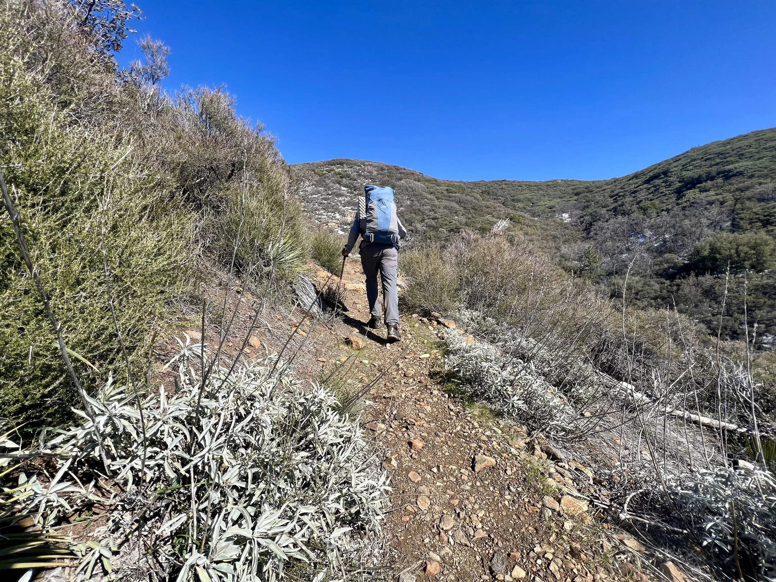
As we finally moved off the paved road and onto a dirt road we both felt much better. Once the road turned back to single track we were moving well again. As we gained the saddle between Los Pinos Mountain and Corte Madera there was no discussion and I followed Pablo toward the peak of Corte Madera. The path started as a 4wd road and after about ½ a mile turned back into a single track. This was a beautiful climb and reminded me in so many ways of the way a climb progresses in the northern reaches of the AT. The trail started out narrow. Very narrow. Trail maintainers had obviously worked annually with clippers to keep the manzanita at bay. There were sections just wide enough to move through sideways. As we continued, the trail would open up and become very rocky and extremely steep just before closing down again inside a tunnel of manicured manzanita. Later we would walk on exposed ridges with amazing views to the north where we had come from. As the trail continued it passed through a dense forest of oak trees and chaparral. In many places the trail dropped precariously 50 to even 100 feet to cross a small depression in the ridge. As we climbed higher, the trees thinned out, and the views began to open up. We were able to see the rugged landscape of eastern San Diego County stretching out before us, with rolling hills, jagged peaks, and deep canyons. The scenery was particularly stunning since it was later in the afternoon, and the sun, with the dramatic clouds, began to cast a warm, golden glow over the entire landscape.
Approaching the saddle between Los Pinos Mountain and Corte Madera.
As we got higher the wind picked up even more. Gusts up to about 50 mph were slamming us. We passed some boulders off the trail that looked like a great windbreak. I was up ahead of Pablo and explored them a bit, plugging them into my memory in case the camping we’d planned up ahead didn’t work out.

Peeks from the climb.
About another half mile ahead we came to our camp spot. Although it was a pretty good windbreak, it was wet. We decided to drop our packs, and hike to the peak. It was a short and easy walk to the summit where we were rewarded with panoramic views in every direction. To the west, we couldn't quite make out the Pacific Ocean through the clouds, while to the east, we could see the rugged mountains and desert landscape of Anza-Borrego Desert State Park. With the clouds moving so fast, the light and colors were changing every few seconds. We took some pictures and enjoyed the view before heading back to our packs. Here we decided to make our way back to the boulders I’d noted earlier.
Summit smiles.
Cold and windy happiness.
In no time at all we were back at the spot. It was only 5:30 in the afternoon and we’d done a bit more than 23 miles for the day. We made camp, cooked dinner and enjoyed the ever changing sky. It was absolutely beautiful and we were both very happy with our decision to hike the peak. Tomorrow would be our last day. Tonight would be windy and cold. We were both going to savor our last night.
Tarp camping to help block the winds.
Spectacular Sunset.
A Google Earth tour of Day 5.
Day 5
Daily Miles - 9.15 miles
Daily Elevation Gained - 997 ft
Daily Elevation Lost- 3117 ft
Total Miles - 86.19 miles
What a night. Wind gusts that surely topped 70 mph during the night and just before sunrise the temperature was a brisk 24 degrees. Luckily when we got up to the 24 degree temps the winds had gone. But earlier in the night, when it was closer to 30 degrees with winds at their tops, it was extremely cold. Using the National Weather Service wind chill calculator, at a temperature of 30 degrees Fahrenheit with a wind speed of 70 miles per hour, the wind chill factor would be approximately -47 degrees Fahrenheit. While I’m not convinced of those numbers, I can say with confidence that the windchill that night was well below zero.
Sunrise from Corte Madera Peak.
Sunrise hit us immediately up on this peak and we were out enjoying the morning light with coffee and breakfast. We broke camp and headed down this beautiful mountain back to the saddle and then we followed the Espinosa Trail back towards the trailhead. The trail was very wet and there were lots of water crossings. The lower we got the more wildflowers we saw. We passed fields of California Poppy dotted with Purple Nightshade, Paintbrush glowing red, brand new Blue Dicks, Sticky Monkeyflower, and Yucca flowering stalks in various stages of bloom. It was spectacular. We arrived back on our 1500 ft section of trail from days before and then made our last (which was also our first) creek crossing on Pine Valley Creek of the trip.
Corte Madera from below.
Water water everywhere.
We finished the trail on a lower section that was filled with green grass, and more flowers. We arrived back at the trailhead at about 12:20 and Derek showed up about 15 minutes later. He had chairs, donuts and an ice chest of beer. We sat in the parking lot forever and shared our trip with him as he shared his food and drink with us.
Adam passes a Yucca.
Yucca!
This was a truly amazing trip. I’ve never had a full understanding of what Southern California Desert hiking looked like. From what I understand, conditions like we saw will probably never happen again in my lifetime. The snow, mud, water sources, and water crossings were all novelties that we were lucky enough to experience. I now know what this part of California has to offer during the late Winter and early Spring. This won’t be my last trip south for sure.
The last mile of an amazing 90 mile loop.
TOTALS
Total Elevation Gained- 13,418 ft
Total Elevation Lost- 13,336 ft
Total miles- 86.19 miles
Major Water Crossings - 15-20
Gear Reflections:
Although the new boots I wore (La Sportiva ULTRA RAPTOR II MID GTX) were perfect for the conditions of this trip (fully waterproof) they beat up my feet pretty good. These are not the shoes for summer travels.
I used my Zpacks Hexamid Tarp on two of the 4 nights to provide some protection above my Borah Bivy. It did a good job as a wind buffer for sure. It has to be set up pretty high to not touch my Bivy and thus create the condensation that will cause my sleeping bag to get wet. I’m still going back and forth between using the Hexamid and the SMD Gatewood Cape.
My Gossamer Kumo 36 performed beautifully. I had an issue with a seam but my local tailor fixed it the day after we returned for 3$.
Two amazing pieces of gear new for the season were the FarPoint Powerwool 150gsm Sun Hoodie and the FarPoint Alpha Duo. The Sun Hoody is bombproof and picked up NO smells at all. The Duo sheds heat when it needs to and provides more warmth than my puffy. It’s also nice to sleep in. With that being said, it’s extremely fragile and I had to repair many pulls and even two small holes upon my return.
Need to remember to ALWAYS replace the BeFree filter at the start of each season. Always!
I had a lot of battery issues on this trip stemming from slow Apple Watch charging and fast Apple Watch battery drain. I’m working on solutions to this.
Still debating on a sit pad for hiking breaks. Pulling out my full length ⅛ inch pad from the back of my pack is cumbersome and pulling out my Dyneema Bathtub floor is as well. Maybe a small piece of ⅛ inch pad just to sit on?
Mont-Bell Chameece fleece gloves fit the bill.