
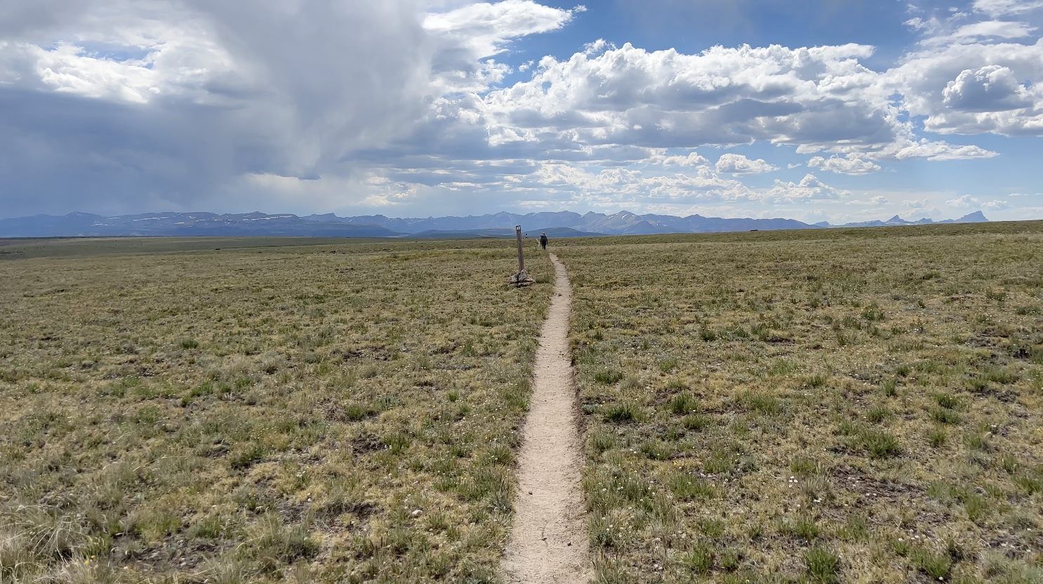
The Colorado Trail 2023
The journey finally begins. Up at 3am. Easy check in and security check at the Sacramento Airport and then onto the plane. So many emotions are pouring through me today. Excited that this long awaited trip is finally here. Looking forward to immersing myself deeply into nature for the next 19 days. Along with all of the anticipation is always a bit of sadness and anxiety. Sadness to leave my beautiful home and yard and my wonderful family that supports me unconditionally with these wild adventures.
Excitement, trepidation, anxiousness. And always some anxiety mixed in as well. Worry if I’ve planned enough. Worry that I’ve planned too much. Worry that my body might not cooperate with my goals. Worry that my planned daily mileage might be a bit too ambitious (as many others have alluded to me).
I have planned this enormous trip of almost 500 miles that includes so many people. My wife, Paula, will hold down the fort for two of the three weeks while I’m gone. My daughter, Isabela, will hold down the fort once Paula leaves on her own trip to Colorado. The two of them, with their own plans, have purchased tickets to pick me up in Durango in 19 days. My sister Lenore and brother-in-law Dusty, taking time out of their summer to meet me three times in three different places with resupply boxes and any extra help I might need. And then there’s everybody I’ve told them walking the Colorado Trail in 19 days given the number of miles needed to finish in that span of time: 26 miles a day. A marathon a day. My past injuries, especially ankles, worry me. A couple of bad rolls could take me off the trail easily, not to mention any other injuries that might come about from age and big mile days. So much on my mind.
But in the end I just want to be present and grateful as much as possible every day, hour and moment. I’m a very lucky man to have the time, means, experience and physical condition to attempt this trip. Here goes nothin’.
Day #1 - 7/11/23
Daily Miles - 25.66
Total Miles - 25.66
Daily Elevation Gained - 4,478 ft
Daily Elevation Lost - 2,539 ft
Calories Burned - 4,074
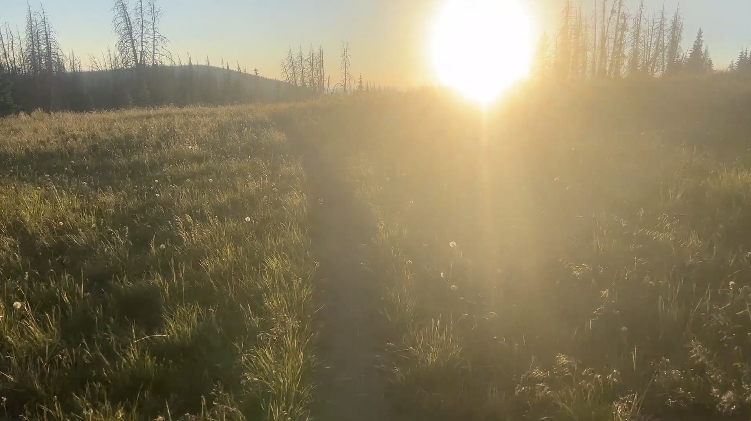
Ryan picked me up without a hitch at airport passenger pick up. We drove the 60 minute or so trip to the Colorado Trail trailhead in Waterton Canyon talking about education, backpacking and life. I can’t thank him enough for taking time out of his day to shuttle me to the trailhead. After a couple of first-day pictures, I was on my way.
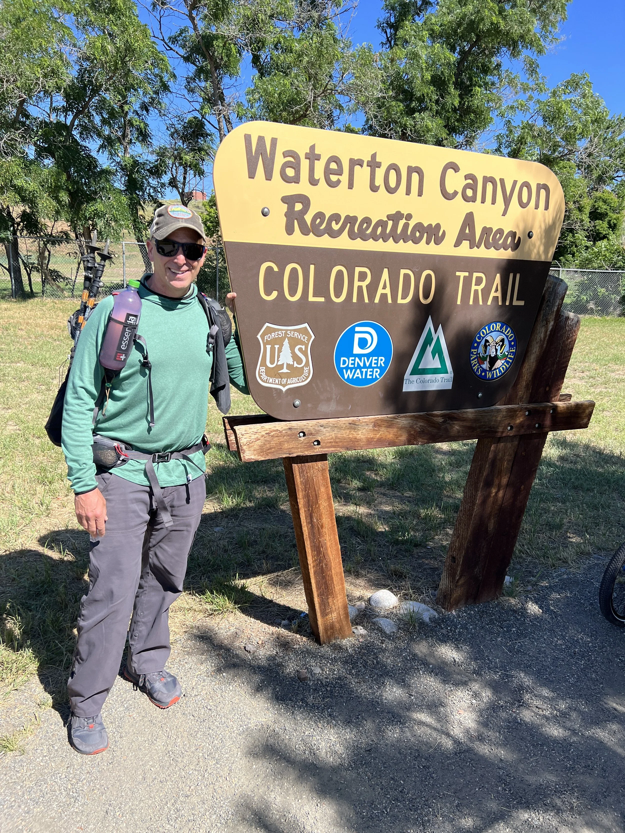
And so it begins…
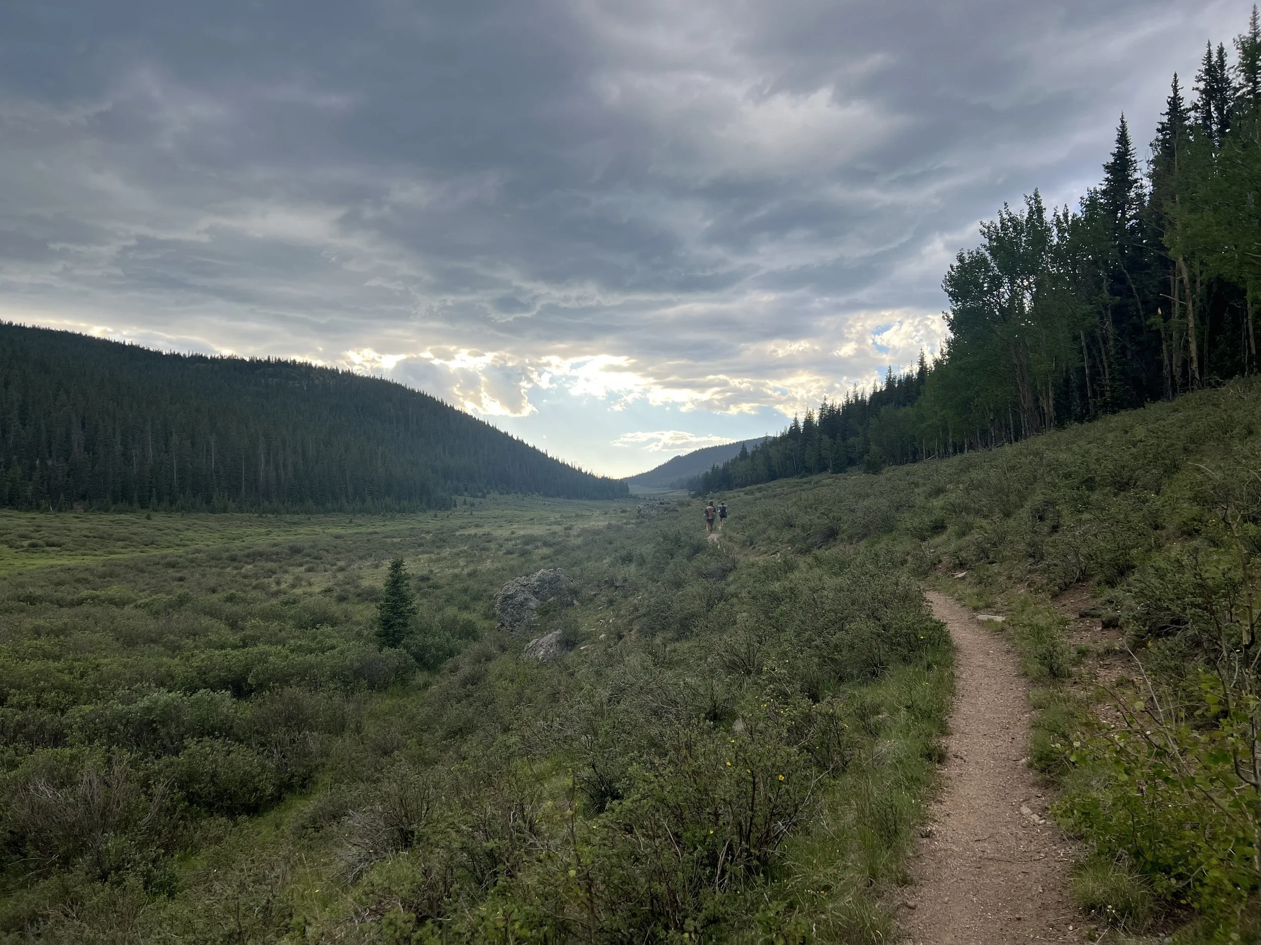
The trail started out with a group of 20 young children on bikes. They were from a local day camp and we played leapfrog for the next couple hours cheering each other on each time we passed one another. They provided me with lots of smiles throughout the morning.
It was a very warm day in Waterton Canyon and growing warmer with every step. I’d heard that today was supposed to be the hottest day in Colorado thus far this year. I wasn’t surprised but I’d done a lot of heat training in Sacramento and the Bay Area for this hike. I read that I should watch for bighorn sheep and saw the silhouette of one up high on a rock as I walked. The heat became too much to handle and at about 4.5 miles in I popped up my Six Moon Designs umbrella to give me some relief. The temperature immediately dropped by about 15 degrees. The Platte River ran next to me weaving in and out of each corner of the canyon.

Bighorn

Pulling out the umbrella in the heat
A couple more miles into the canyon I passed a kid with a backpack hanging uncomfortably and sideways along with way too many things tied and clipped to the outside. After chatting for a few minutes, it was obvious he had committed to something that he wasn’t prepared for and was heading back to the trailhead.
Met a hiker named “Deals” at a stop for water at mile 8 (the last water till mile 16) who was a former AT thru-hiker. We chatted for a bit before I took off. Later, I met a couple named “Venture” and “Miss Adventure.” They were hiking segments one and two of the 28 CT segments. Another few miles in I met “Gareth” and “Steven” from Omaha, Nebraska. They took the train out to Colorado to hike the CT. It had taken them two days to get where I saw them 3/4 of the way into my day one. One was quitting at the next road crossing while the other was going to give the one who was getting off the trail some of his gear and then hoping to make it to Durango. So many different stories out here.
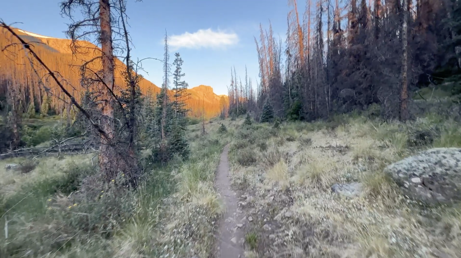
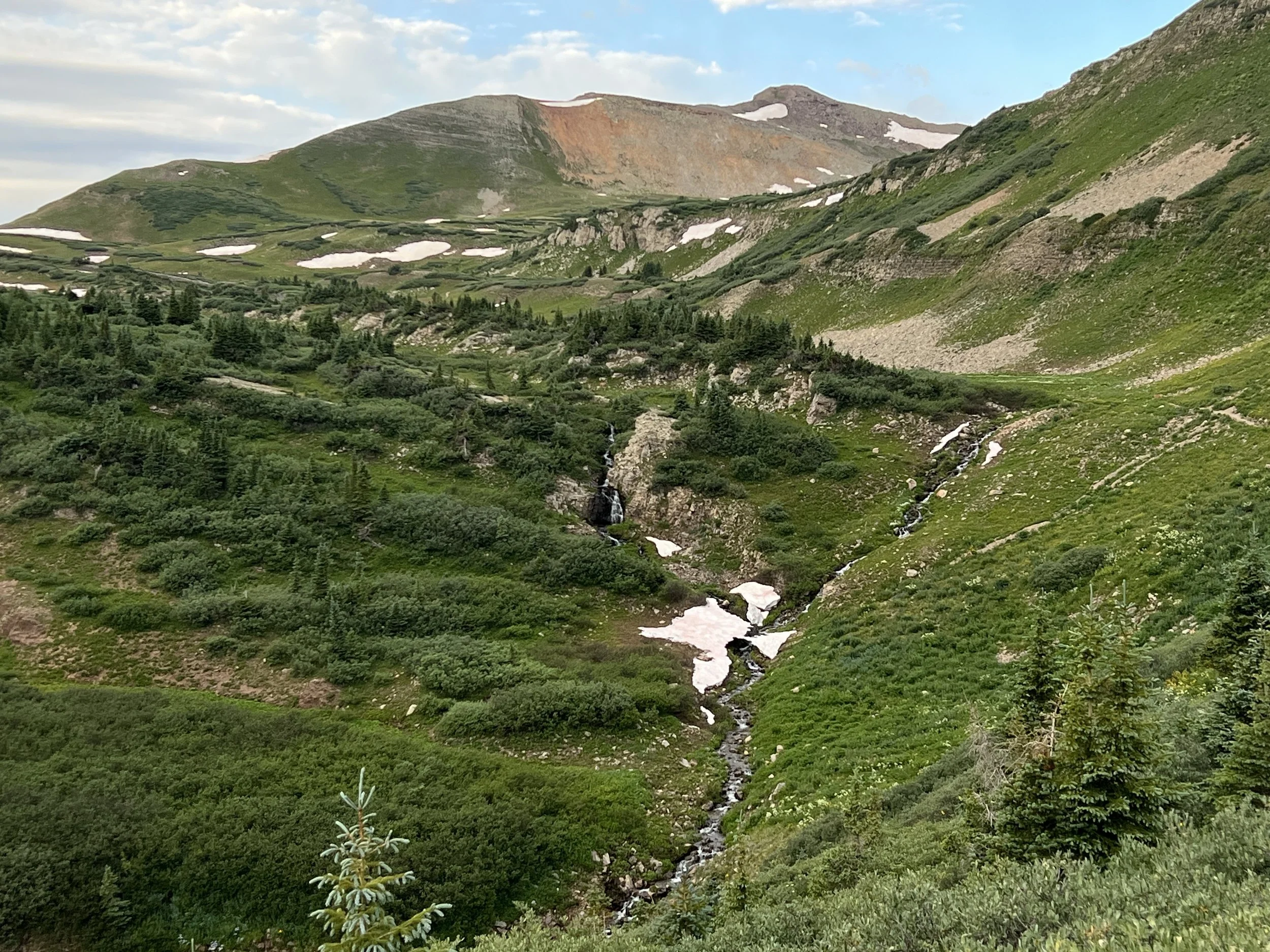
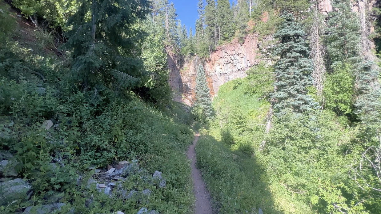
Burn scars
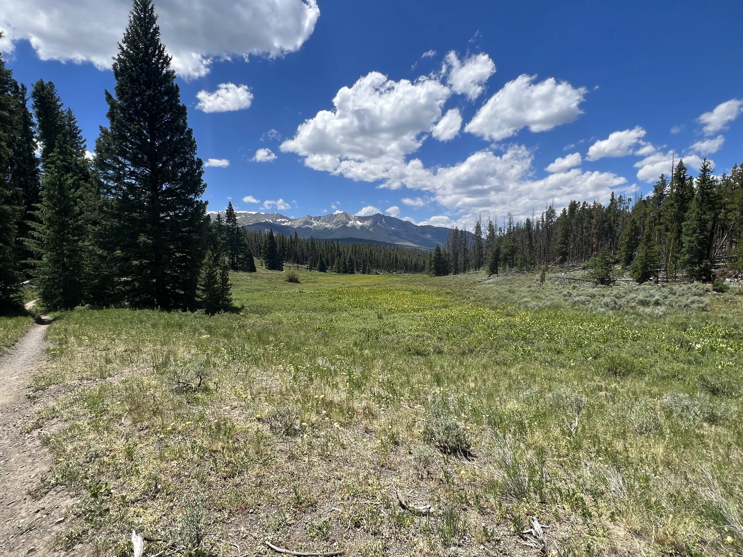
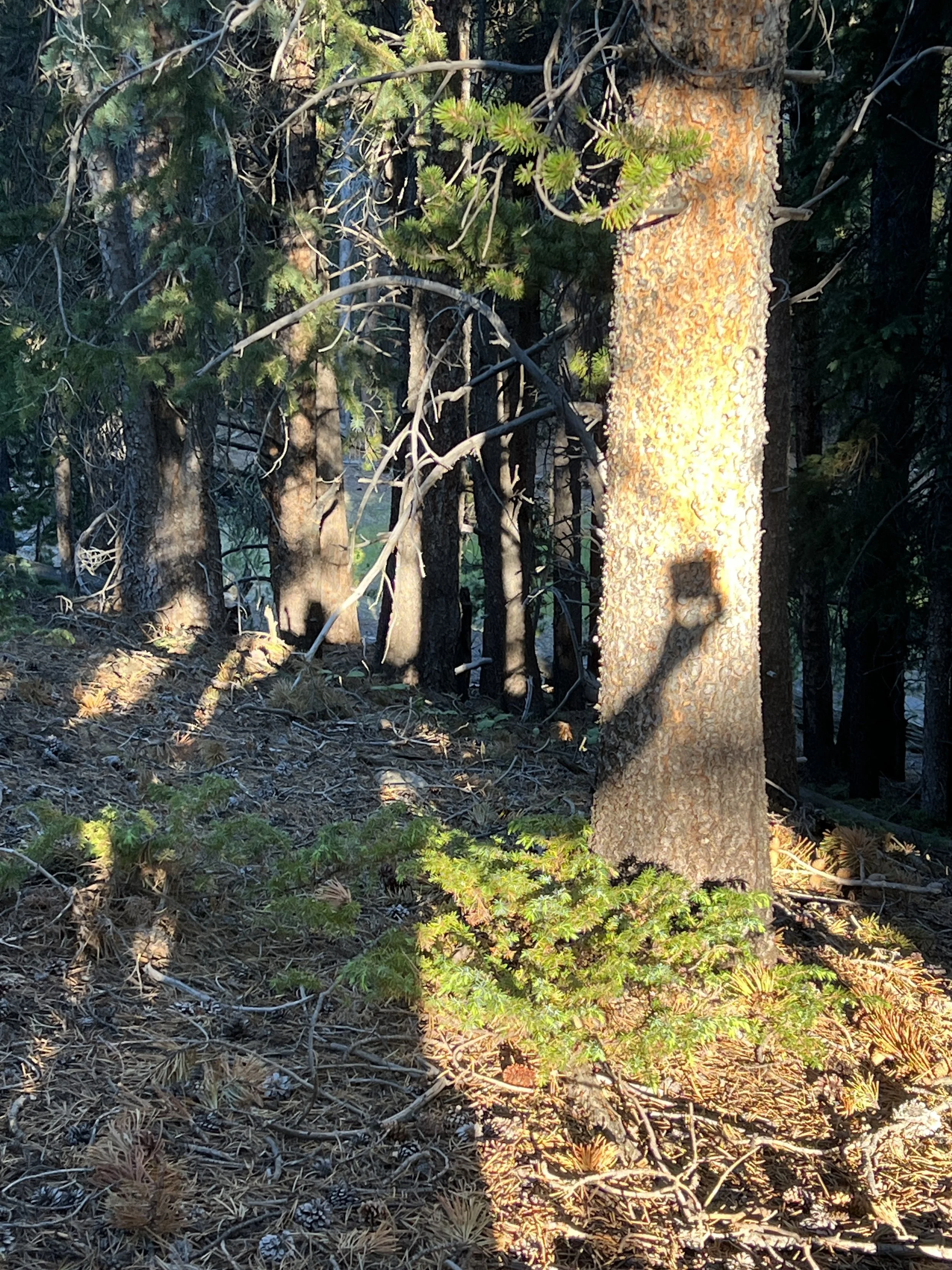
The trail continued into segment 2 and with it, an enormous burn scar. A fire had swept through here years ago and hiking here was devoid of shade. Miles of hot air, dirt and hiking. It was a tough day one for sure but being able to stay at “lower” elevations and slowly acclimate to being up high for about 17 of the 19 days was very helpful.
First night campspot
Day #2 - 7/12/23
Daily Miles - 30.72
Total Miles - 56.38
Daily Elevation Gained - 5,364 ft
Daily Elevation Lost - 2,343 ft
Calories Burned - 4,275
I hiked till about 9pm last night. I set up camp (no tent and just an ultralight bivy over my sleeping bag) and was laying down by about 9:30. I slept well overall but did wake up quite a bit during the night tossing and turning. I woke up for good to my alarm at 4:30 am and slowly made my way out of camp. I officially hit the trail at 5:15 am to a beautiful nautical twilight. This is the dark blue sky with stars starting to fade after astronomical twilight which is the dark sky that lasts the night.
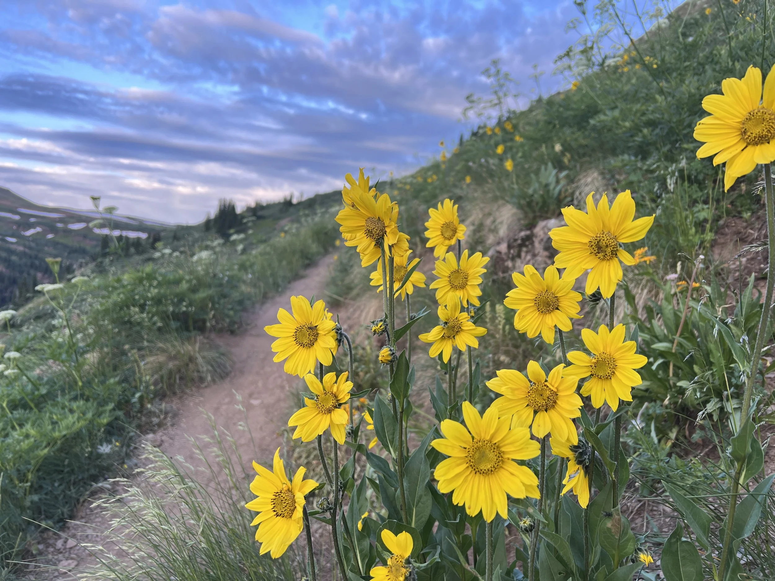
Within the hour I was at the fire station where the volunteer fire department allows hikers to fill up water at a spigot on the back wall of their building. I took my time eating breakfast and making coffee. On the walk away from the station, I met Tish and her hiking partner with Will, their dog. Unfortunately, Will’s paws were pretty torn up and the two were having someone meet them at the road to pick up the dog. All were sad. This would be the first of many dogs I would see that had to leave the trail because of injury. As I continued walking I was able to watch the beautiful sunrise from the trail.
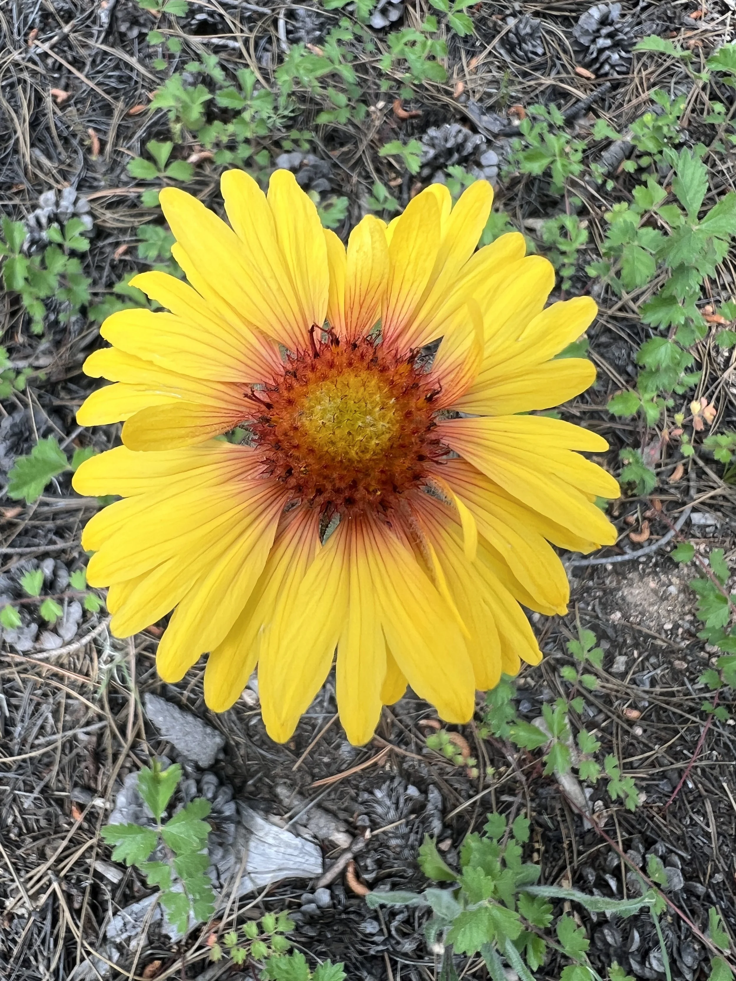
Welcoming sunflower
I saw a few deer during the morning and I heard some gunshots in the distance that would grow louder as I walked south. The walk through the trees was delightful. I was out of the burned area and back in occasional shade. I took a break at an unnamed stream just before an 11 mile, 3300 foot climb. I was hoping my body would hold up. Later, I passed a sign alerting hikers to stay on the trail as there was a Rifle Range nearby. Hence the many gunshots.

Danger…
Later, I met a nice group of hikers at the very top of the toughest climb thus far just after the boundary to the Lost Creek Wilderness. Two couples and two singles. One of the singles had two dogs and reminded me a lot of Northwind that I hiked with 23 years ago on the Appalachian Trail. Truly another lifetime ago. Trevor was from Morro Bay. He grew up there. He went to Cuesta College and took some music classes. He never had my friend Michael as a professor but knew of him. Small world.
The group continued talking. I got up and hiked on, as I had many more miles to go.
I stopped and found another nine hikers at the Lost Creek dispersed camping area. A gentleman and his nephew had some trail magic set up. It was amazing. They had soft drinks, Gatorade, fruit, chips, and cookies. They also had clean water and nothing but hospitality. It was a true gift and I got to talk to some other hikers as well. I got back on the trail at 6:00 pm to do a few more miles.
Lost Creek Wilderness
Day #3 - 7/13/23
Daily Miles - 30.30
Total Miles - 86.68
Daily Elevation Gained - 4,465 ft
Daily Elevation Lost - 3,596 ft
Calories Burned - 3,808
Big day yesterday. I ended the day with Trish and Trevor hiking through the Lost Creek Wilderness meadows looking for big game in the dwindling evening light. I walked further than they chose to walk (a mantra that would continue each and every day) and did a little over 30 miles for the day. Because of some raindrops, I had to set up my tarp and didn’t sleep quite as well. I woke up at 4:00 am to a cold and dry morning and was on the trail by 5:00 am. I stopped for breakfast at about 7:30, rested till about 8:00 am, getting to meet a few hikers who passed by. One of those hikers was 71 years old and from Maine. Very inspiring.

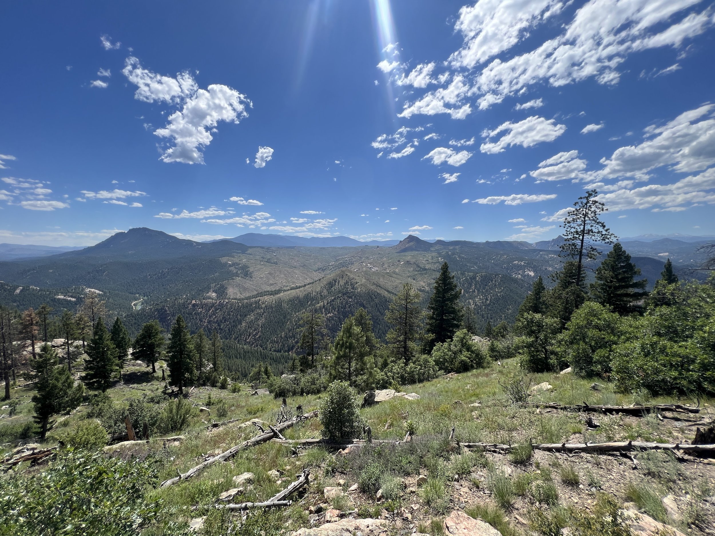
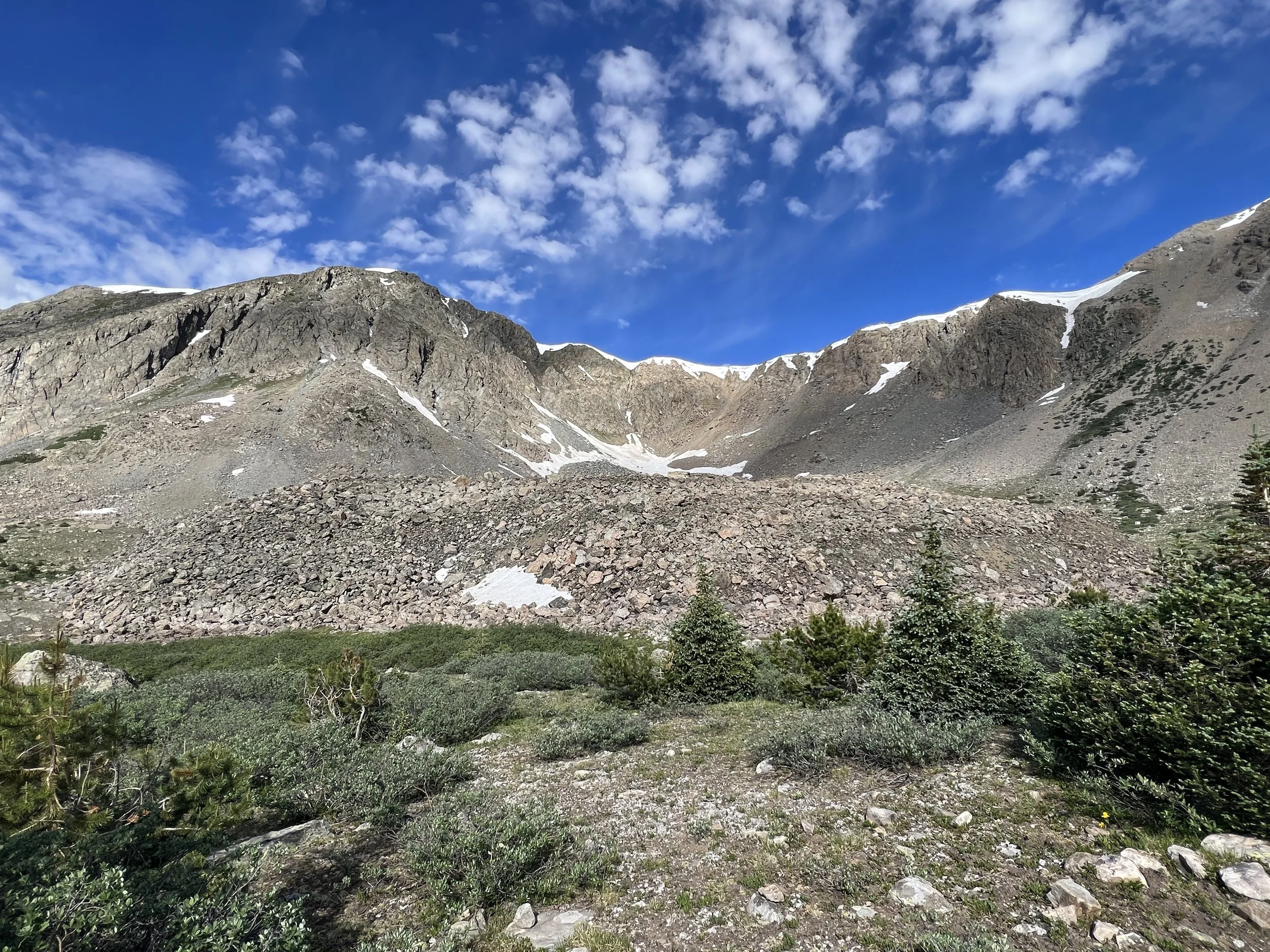
First Sights of BIG Mountains.
I played leapfrog with some hikers this morning on the hike to Kenosha Pass. Once I got to Kenosha Pass, “Caveman” was there throwing out some trail magic. He had sodas and he took our trash.
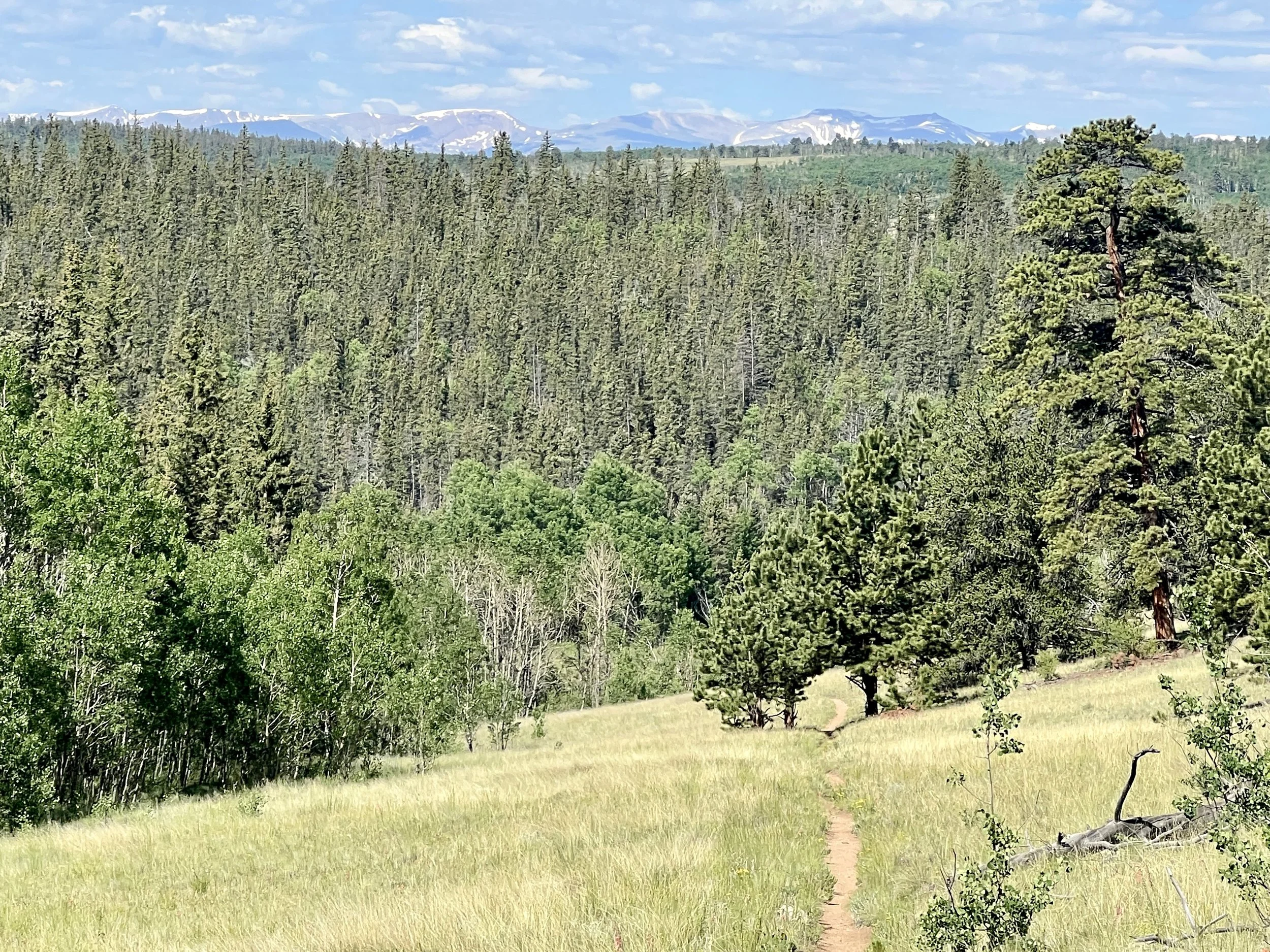
First sights of BIG mountains.
Descending to Kenosha Pass, the outside of my right knee really started to hurt. It was pain like I’d never experienced before. While resting with “Caveman,” I went ahead and put my salve on it and took some Advil. The first mile into my walk, as clouds were building, it felt a bit better. But, as the miles continued, it got worse. A lot worse. I stopped at Jefferson Creek where there were lots of campers and even more bugs. I had dinner, talked to a few hikers about my knee to see if anyone knew much about knees. One suggested that I soak it in the river and I did just that. After dinner I decided to continue on. Camping with this many people and this many bugs just isn’t my thing. Georgia Pass was only about 7 miles ahead and I really wanted to camp up high. As I continued hiking, my knee went from excruciating to just plain painful. I was hopeful that the gentleman at Jefferson Creek that suggested that the pain was “just a bit of arthritis” and would come and go, was correct.

Bivy campspot
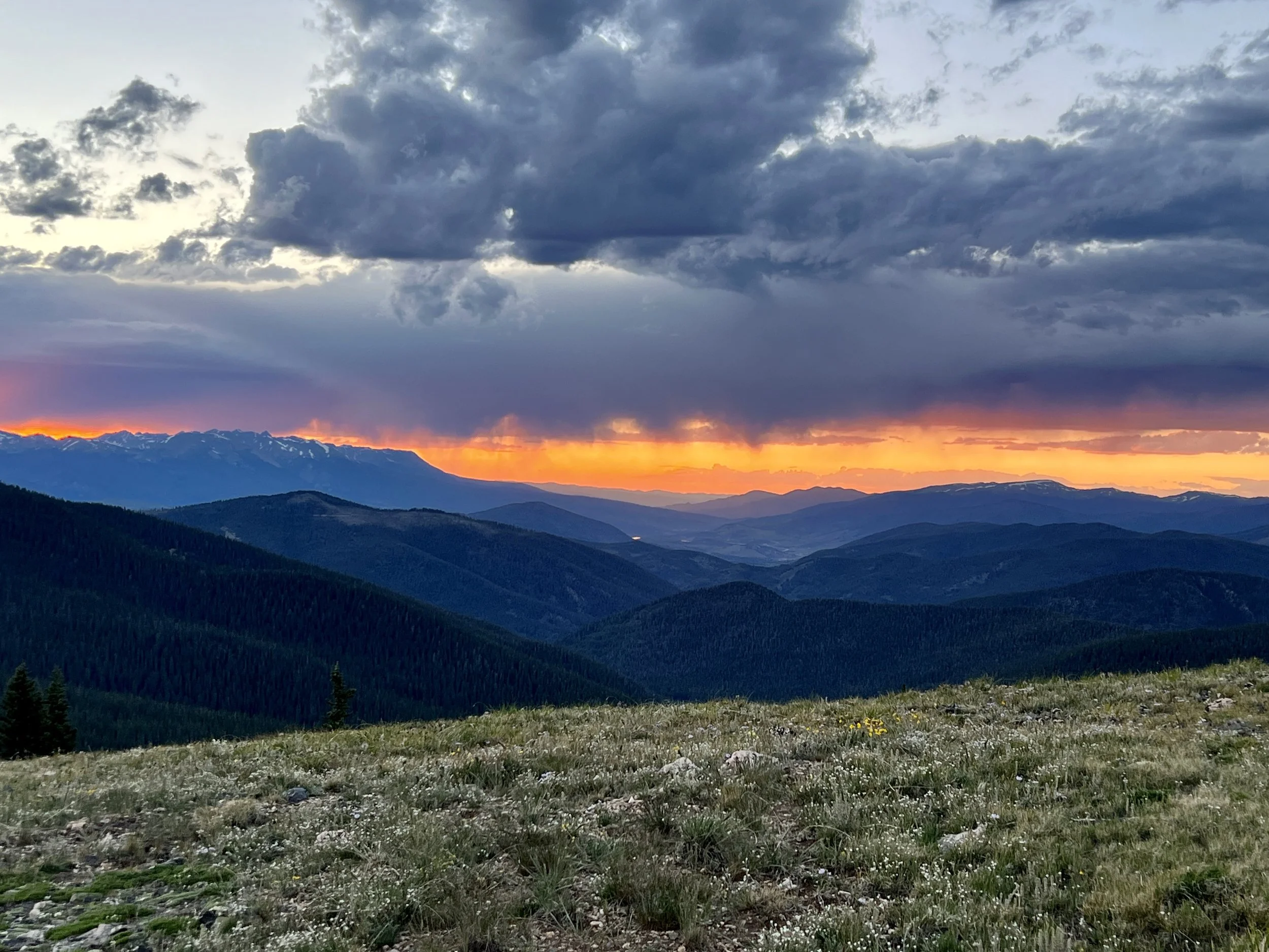
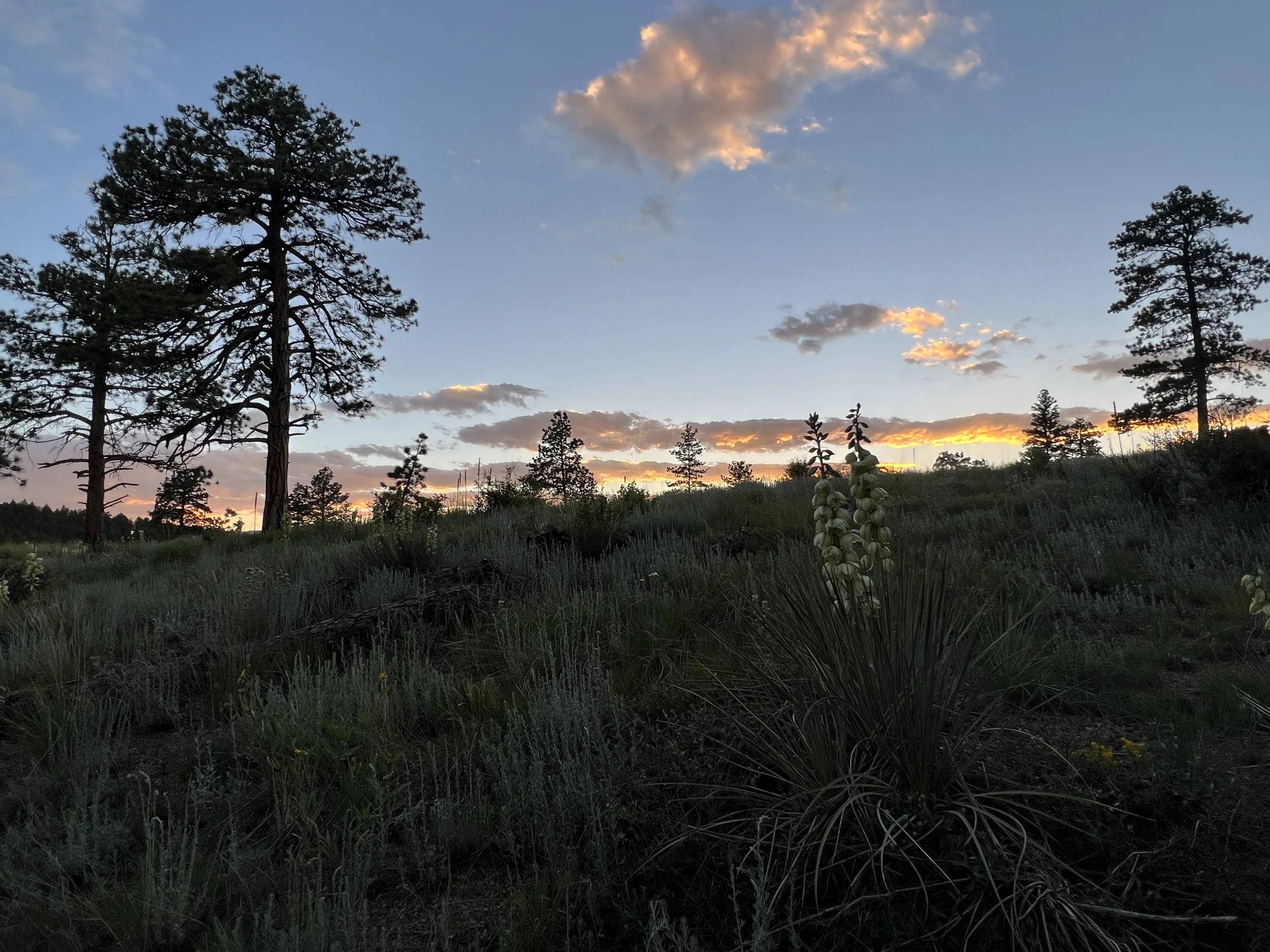
Georgia Pass Sunset
Day #4 - 7/14/23
Daily Miles - 25.87
Total Miles - 112.05
Daily Elevation Gained - 4,141 ft
Daily Elevation Lost - 5,331 ft
Calories Burned - 3,067
The climb up to Georgia Pass last night was truly stunning. My knee felt pretty good in the final miles. I’m not sure if it was the soaking, the Advil, or the fact it was uphill (much easier on the body), but I was grateful indeed. I set up camp at the top of the pass, just as I wanted. I caught an amazing sunset with stunning colors in every direction. I only set up my bivy with the bug screening tied up with my trekking pole to protect from the bugs that were still out. At about 10:30pm I opened my eyes to a few raindrops. I scurried out of my sleeping bag and got my tarp set up in no time at all. It’s nice to know how fast I can get the tarp set up if it does start to rain at night, as I always prefer sleeping without it. I woke up a few times at night feeling like I was ready to hit the trail again, but I knew my body needed more rest and so I waited till my alarm at 4:00am to start packing up camp.
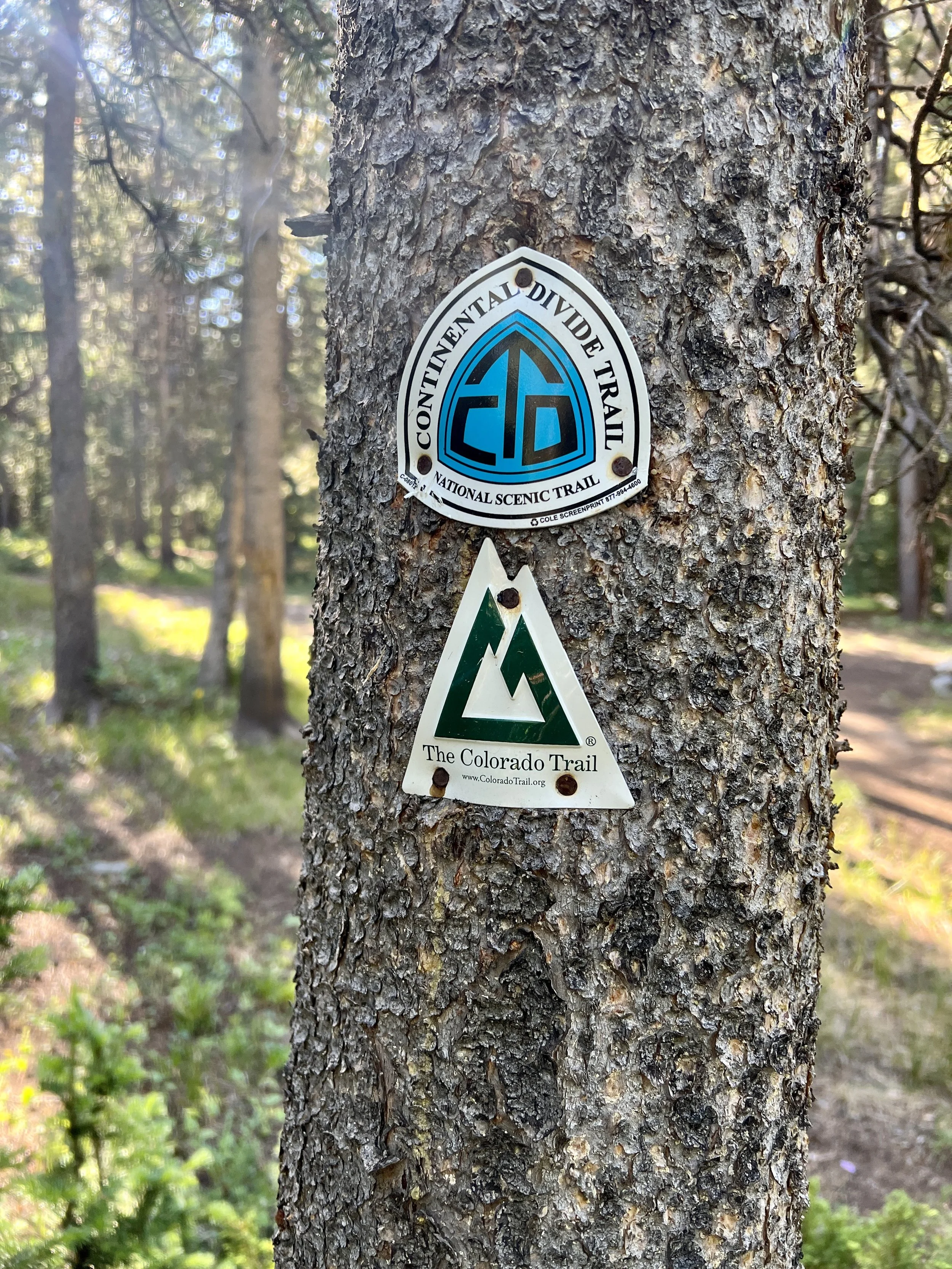
Joining the CDT
I dropped off the saddle of the pass and almost immediately the Colorado Trail (CT) joined the Continental Divide Trail (CDT) which runs 3000 miles from the border of Mexico to the border of Canada. My knee was holding up OK, but I was looking forward to getting some Tylenol to go back-and-forth with my Advil as well as an ace bandage to tighten up my knee.
I stopped for breakfast at the first Swan River Crossing. There were many hikers camped, and I set up for breakfast away from the others. A very nice woman with a dog named Hank stopped to chat with me. After breakfast, the downhill continued into an area close to a very large kennel I’d read about months ago. The dogs were barking and howling and squealing in a very surreal sounding way deep in the forest. The forest was littered with dead trees, and it made for a little bit of a creepy atmosphere.

Boo!
As I came around a corner, I found Hank, his owner and three other female hikers. All were stopped and two were trying to hide in the bushes. They had not read about the kennel and were convinced that a pack of wild dogs was headed up the canyon to attack. After a short chat they felt much better and I slowed down to walk with them until we got to the kennel. The facility was amazing. There must have been 150-200 Alaskan Huskies all in pens around some central buildings. The grounds were immaculate and, once we got close enough for the dogs to see us, all the barking and howling ceased. I said my farewells to the other hikers, and like would happen every day forward, never saw them again.
My knee was an interesting animal. I could go for quite a long time, up to an hour, maybe more, without feeling any pain whatsoever. Then, out of nowhere, I could hardly walk and was just hobbling. Luckily, it seemed that those painful periods of time wouldn't last forever. So each time the pain flared up, I’d slow my pace, change my gait and wait for the pain to go away.
At about 4:00 pm my day changed considerably. My sister, Lenore, and her husband, Dusty, were supposed to meet me the following day with my resupply box. They live in Colorado and are pretty central to the trail corridor and had graciously agreed to meet me at the trail on day 5, 10, and 14 with prepacked resupply boxes. I’d packed food for each section and also a “Bounce Box.” The Bounce Box had extras of things, repair items, warmer layers, etc. It would serve as a safety net in case I had planned wrong in various ways.
Approach to Highway 9
Lenore and Dusty had rented an AirBnB for the night in Frisco and I was just crossing the road a few miles away from that town. I had called them and they were about an hour away and agreed to meet me at the trailhead. While I waited, I visited with a section hiker named Cane. We had a terrific conversation over the hour. I truly enjoyed my time with him as the chat I had with him had been the longest conversation I’d had with anyone in the last 4 days. It was a very enjoyable time.
Lenore and Dusty got me just after 4:00 pm and we headed to their rental. On the way, I ate handfuls of cherries and a peach that they had brought. Once at the rental, unfortunately, the owners would not let me stay the night as I’d hoped citing “very strict rental rules and neighborhood scrutiny.” I used their driveway to sort through all of my gear and get ready for the next 6 days. Then, I slyly entered the rental and took a quick shower before the three of us went out for dinner.
After a beer, I ate a Caesar salad, cheese and spinach ravioli with pesto sauce and marinara sauce as well as a third of a pizza. My plan was to hike back out with pizza for the trail. I’d end up doing this after each and every town stop on the CT. It was amazing.
We stopped at WalMart for more drugs and an ace bandage. I wanted to make sure I was ready for that knee pain. (Ironically, I felt the pain for short periods of time the next day, but then never again did the pain resurface).
Then it was back to the trail. My plan was to hike as far as I could before finding a place to get some rest. They dropped me off just after sunset and I turned on my headlight to light the way not long after.
It’s not the way I roll, but damn I should have my sister bring the new 10 pounds of food to our original meeting place in Copper Mountain. It would have been 16 miles with 10 pounds less on my back as I climbed up and down the Ten Mile Range. It’s a section where lots of hikers “slack-pack” meaning they day-hike the section getting a shuttle from one end to the other and leave their gear at a local hostel.
Walking alone at night provides a lot of time to think. I just realized how much I ate. I feel full right now, but also feel some of the strongest I felt since the trip started. Guess I need to start eating more. I’ve had a lot of trouble eating during the day. I think it’s the combination of the heat and the extreme physical exertion I’m putting forth during all of my waking hours.

Frisco at night
Day #5 - 7/15/23
Daily Miles - 30.60
Total Miles - 142.65
Daily Elevation Gained - 5,919 ft
Daily Elevation Lost - 6,309 ft
Calories Burned - 4,500
I walked about 4 1/2 miles last night. I had planned to get to the high point on the ridge, but after walking for a while, figured out that that was going to be 8 miles and that I wouldn’t get there until about two in the morning. So I decided to stop at about 11:30 pm. I set up camp quickly and fell asleep fast. I woke up about 4:00 am and got started packing up at 4:30. I left camp at about 5:00 am and walked into nautical twilight. A bit later I walked into an area where one hiker was doing some laundry in a creek. After a few more minutes, I passed a group of tents and a couple dogs off leash. Both dogs were quite aggressive and the owner was still in her tent just calling them back. The dogs were not listening and I had to use my trekking poles to keep the snarling hounds back. (Although this was quite uncomfortable, these dogs would be the only aggressive ones on the entire trip). I’m not fond of that. If you’re gonna have dogs on the trail, they shouldn’t be aggressive. Period.

Ten Mile Range Ascent

Searle Pass Approach

Searle Pass
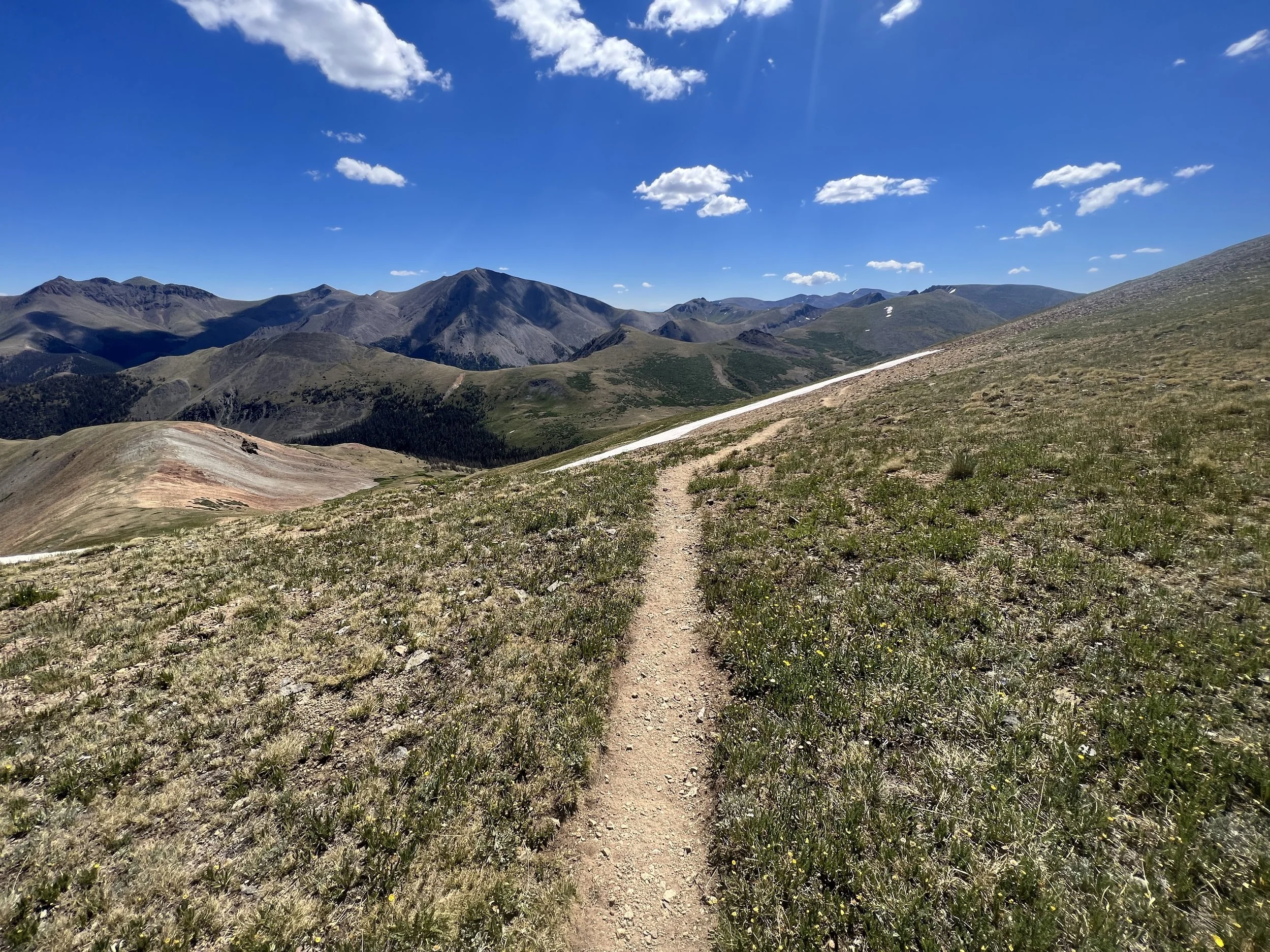
The climb up to the high point was big. Six more days of food in my pack made it even bigger. Once at the top, I spread out all my gear, went through everything, cleaned things up, looked at the next five days on my maps and felt good. Today will be a big drop and then a big climb but the next two or three days won’t have climbs or drops as big. Good to know.
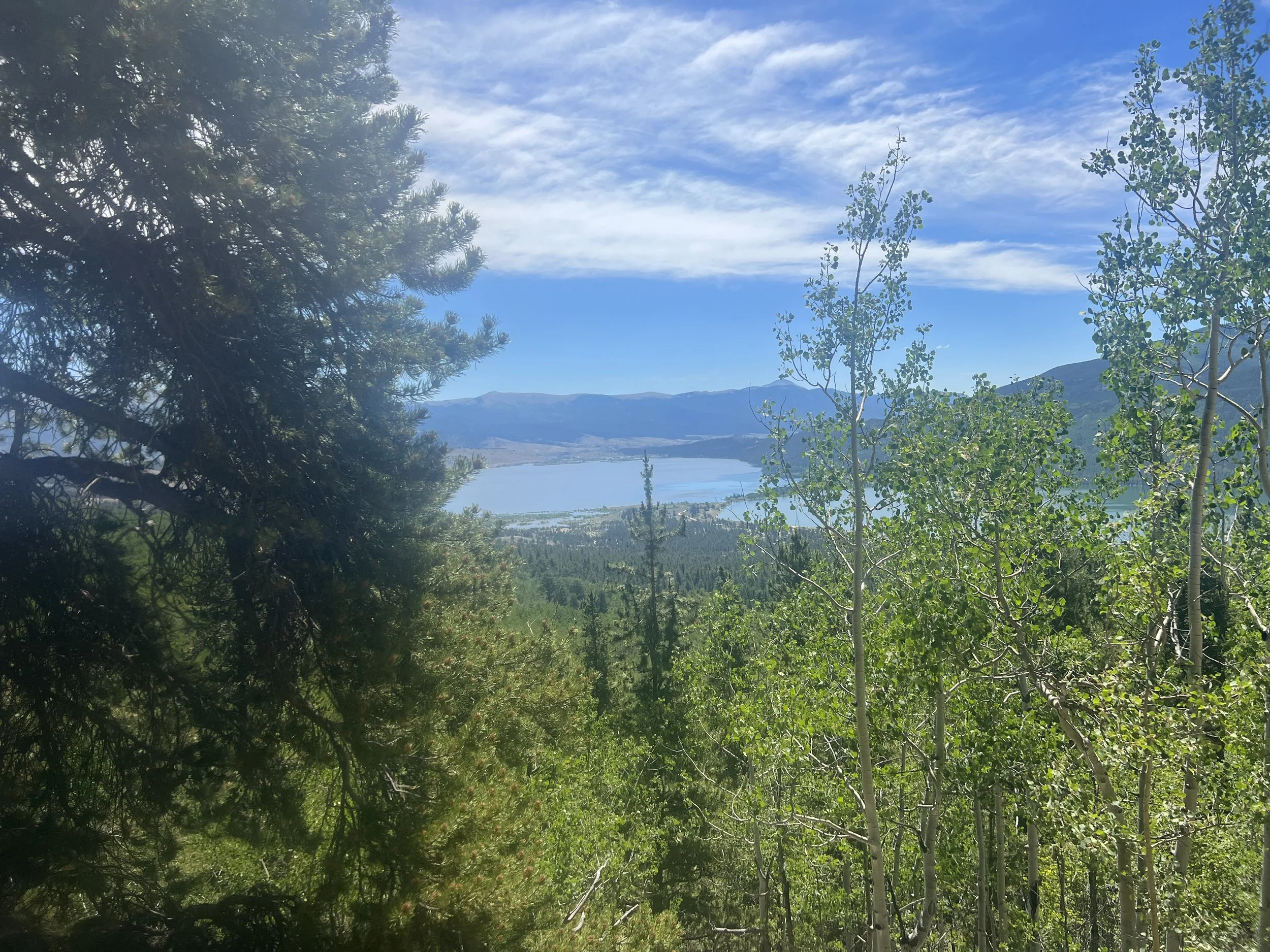
The view from where I rested was amazing. I could see the Collegiate Mountains covered in snow where I’ll be the day after tomorrow and was looking straight down at Copper Mountain on one side and Breckenridge on the other. Stunning.
The pizza was amazing for breakfast. No type of pizza is bad cold backcountry pizza. It doesn’t exist. (I’d find out later this wasn’t true).
I dropped almost 3000 feet to the Copper Mountain ski resort. I was disappointed to find that there was an almost 2-mile detour at the bottom because of a ton of construction at Copper Mountain. The “trail” led directly through Copper Mountain Village. I stopped at a gas station for a soda and chips and then walked through the rest of the village’s swanky shops, restaurants and even a Starbucks. I was glad that my support team (Lenore and Dusty) hadn’t met me at Copper Mountain as planned. Not only was it a mess because of construction, but there were hoards of people which would have made finding each other, sorting food and visiting very difficult.
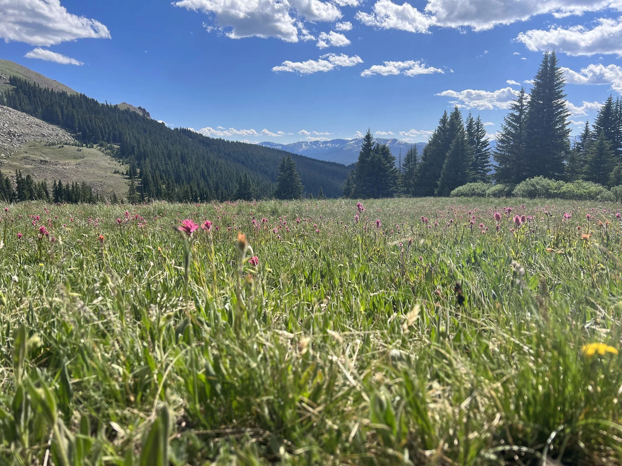
Wildflowers begin
Hiking out of Copper Mountain put me in a gradually ascending canyon towards Searle Pass at 12,046 feet. The canyon was lush with greenery, wildflowers, pine forest running through the middle, and steep walls on either side. There were many day hikers and mountain bikes on this trail.
As I climbed higher, I could see the peaks of the pass that I was aiming for. It was a 2,300-foot climb and I felt every step of it. About 3/4 of the way up, I met a group of 4 . Two were from Australia, one from Boston, and one from Austin. After chatting, they hiked behind me for a lot of the morning and caught me having some pizza at the top of Searle Pass. I also met another hiker at the top of the pass who went by “Knoxville.” I followed him for a good amount of the day. He told me he was heading to Leadville from the pass which sounded interesting to me in terms of another meal. In the end, I didn’t think I had enough gas in my tank to get me to Leadville that night as it would have been about 35 miles.

I chose the wrong line through the mud
I left the pass and hit a section where I could see at least a mile or two of trail in front of me. I played leapfrog with the group of 4 most of the day but never saw Knoxville again.
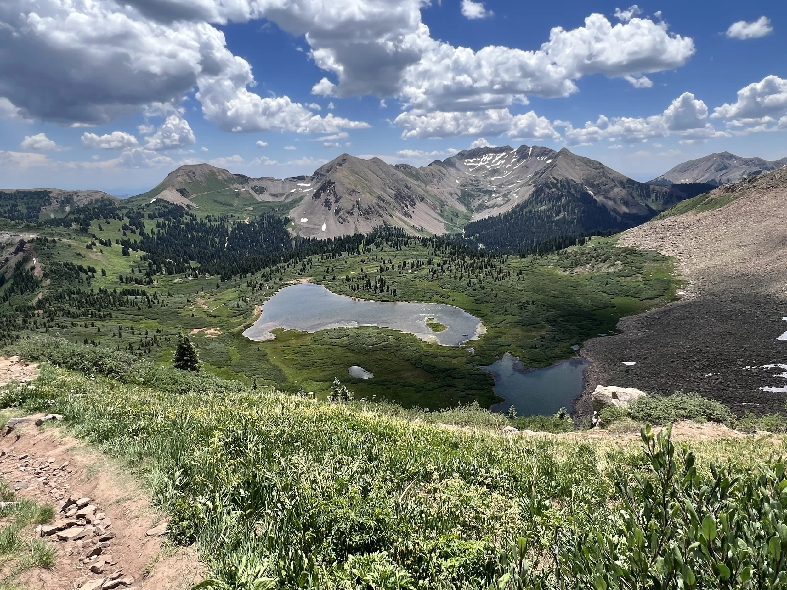
Once I got on top of Kokomo Pass at 12,024 feet, I was in awe. It was as spectacular as anything I’d walked through yet. The 13,000 foot peaks all around me were lush with green foliage and wildflowers everywhere. It is so different from my California Sierras as the mountains here have greenery and lush wildflowers all the way to the top. So so very different.

Marmot
I can’t remember the last time that I was in such a perpetual sense of heightened awe for such a long period of time. The Colorado Trail has done a number on me in such a short time already.
Approach to Kokomo Pass
My day started to wind down as I hiked along a dirt road into one canyon and then another canyon. Tonight I had to camp close to a Highway so that I’ll be close to the other highway to hitch to Leadville for breakfast. More “real” food is needed. Today’s 30+ miler tuckered me out.
Day #6 - 7/16/23
Daily Miles - 23.31
Total Miles - 165.96
Daily Elevation Gained - 4,392 ft
Daily Elevation Lost - 3,410 ft
Calories Burned - 3,690
I hiked to exhaustion last night. I had made it 30 miles and camped right above Highway 24 which luckily, was a very quiet highway. I had to take some meds when I lay down because my feet hurt so much. Otherwise I was feeling good. Even though I was camped near a highway, I think I slept longer and more soundly last night than any other.
I woke up to a very cold morning. Once I started walking, I looked at my thermometer and it was a 33° chilly day. It was only about 5 miles to the Leadville highway where I planned on hitchhiking and having breakfast and hitchhiking back out.
Highway 24

The Hitch to Leadville
Once at the road I dropped my pack and stuck my thumb out. After a few minutes a Sprinter Van pulled out of the parking lot behind me and asked If I was going to Leadville. “Uncle Nomad” and “Mystery” were my ride. He is hiking the CDT and she is following in the van and supporting him. A good deal if you ask me.
Breakfast was amazing. One of the best vegan breakfast burritos of my life. Once done filling my belly, I headed back out onto the main street. I started walking towards the trail with my thumb out. As I turned the corner, a man putting out his Razor 4-wheelers at his business told me to try hitching on his corner, explaining that I could get tourists coming from one direction and locals from the side street. He thought I’d have a good chance at getting a ride.

Amazing Breakfast
I dropped my pack and stuck out my thumb. After about 15 minutes of trying and smiling I still hadn’t scored a ride. A local police officer was approaching me and I instinctively pulled my thumb in. He gave me a little smirk and continued on his way. A few minutes later, another police officer drove towards me as well. I did the same thing but it garnered no smile whatsoever. At the end of the block he turned and before I knew it he had pulled up inches from me and rolled down his passenger window. With a stern look he said, “No hitchhiking in city limits.” To which I replied, “What, the last police officer that drove by smiled at me.” At that point he got out of his car, slammed the door and walked directly at me. He stopped with his nose just inches from my forehead and yelled, “No hitchhiking in city limits!” I stammered filled with emotion. I wanted to yell back. I wanted to push him away from me. I wanted to punch him in the face. But somewhere in the back of my mind I knew that if I did any of this he’d throw me in his car and put me behind bars.
I said nothing, turned around, picked up my backpack and started walking. It was almost 3 miles to the city limits. Planning on just sticking my thumb out again once he drove away, he stymied my plan by literally following me for the next 30 minutes. He would drive past me about 100 yards, pull into the driveway, and just stare at me until I passed him. Then he’d pull out and drive another 100 yards to park and do it again. This lasted for about 2 miles, at which point I ducked into a gas station for a Coke and when I came out he was gone. By now, I was very close to the highway split that led to the Tennessee Pass and the trail and just finished the walk to the split and the edge of city limits. As I sat my pack down and stuck out my thumb a jeep immediately pulled over. He’d seen the entire event and waited to pick me up till I was out of the city limits. He told me he’d never seen something like that happen in Leadville before and thought that it had been the Sargent himself I’d been dealing with. He picks up hikers all the time. He told me he was blown away to hear about my interaction with the police. I don’t remember what time I left the pass and I think I was gone a bit more than two hours. Great burrito, rough stop.

Holy Cross Wilderness
Today I entered the Holy Cross Wilderness. All high elevation and stunning. I left the trail for a bit today and went to Bear Lake. There were a multitude of lakes in the Holy Cross section. Bear Lake was one that I’d heard had leeches. There were no leeches. It was a spectacular lake. I swam and ate, washed and relaxed for over an hour and didn’t see a single human being. Much different than the sometimes crowded Colorado Trail. The extra 1.5 miles off the trail were well worth the swim and serenity.

Bear Lake
It turned into a taxing afternoon. The almost 2000 foot drop out of the Holy Cross wilderness was on an uneven trail of rocks and roots. It was very hard on the body. Downs just rattle the bones. I’d always rather go uphill than downhill.
It started getting to me mentally, so I put in an earbud for the first time with some music. My daughter had made me a long playlist of songs she knew I loved, and songs I didn’t know but she thought had a beat that could get me and keep me going. Oh was she right. It helped me get down to the bottom.
Shadow Fun
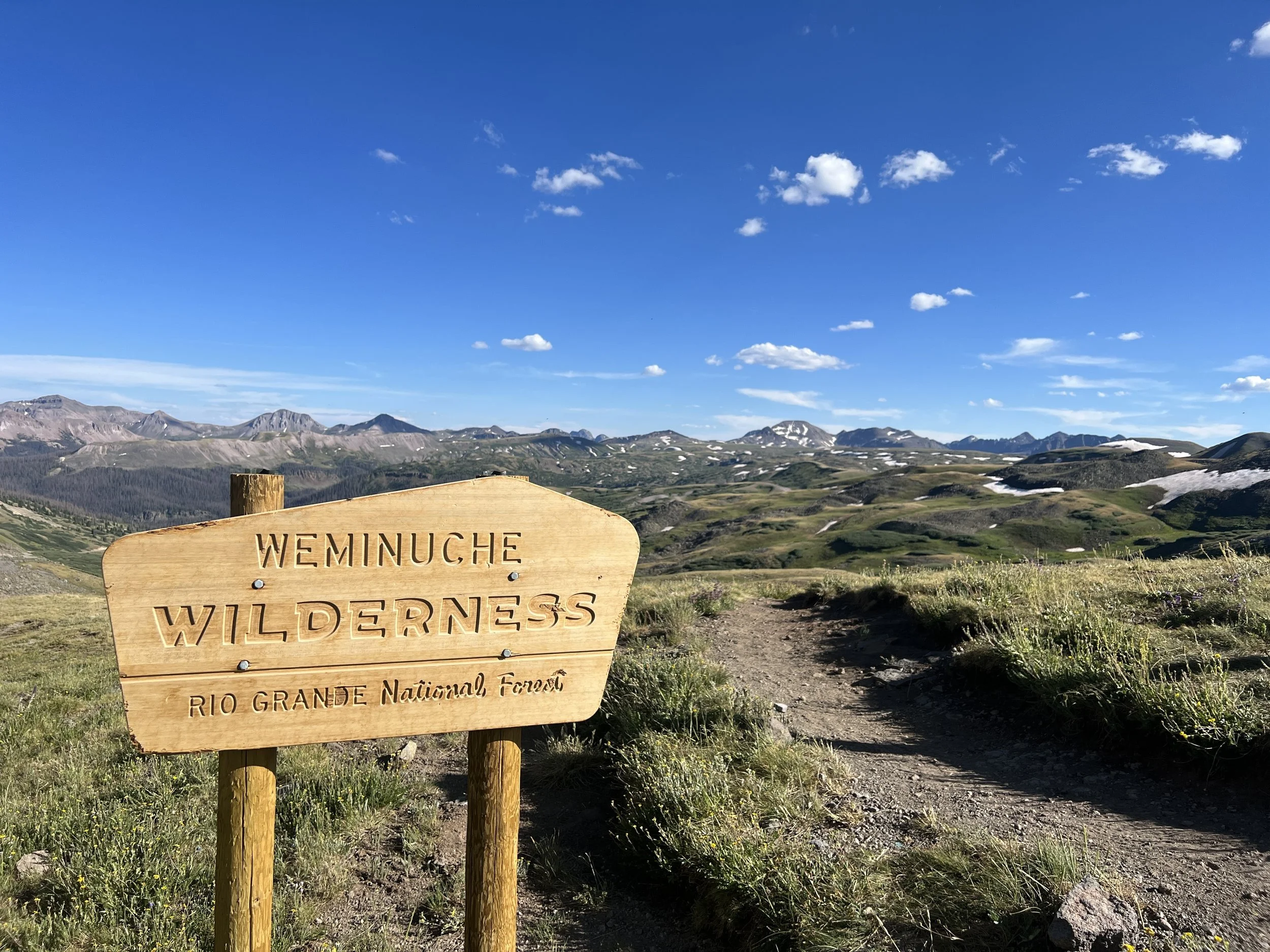
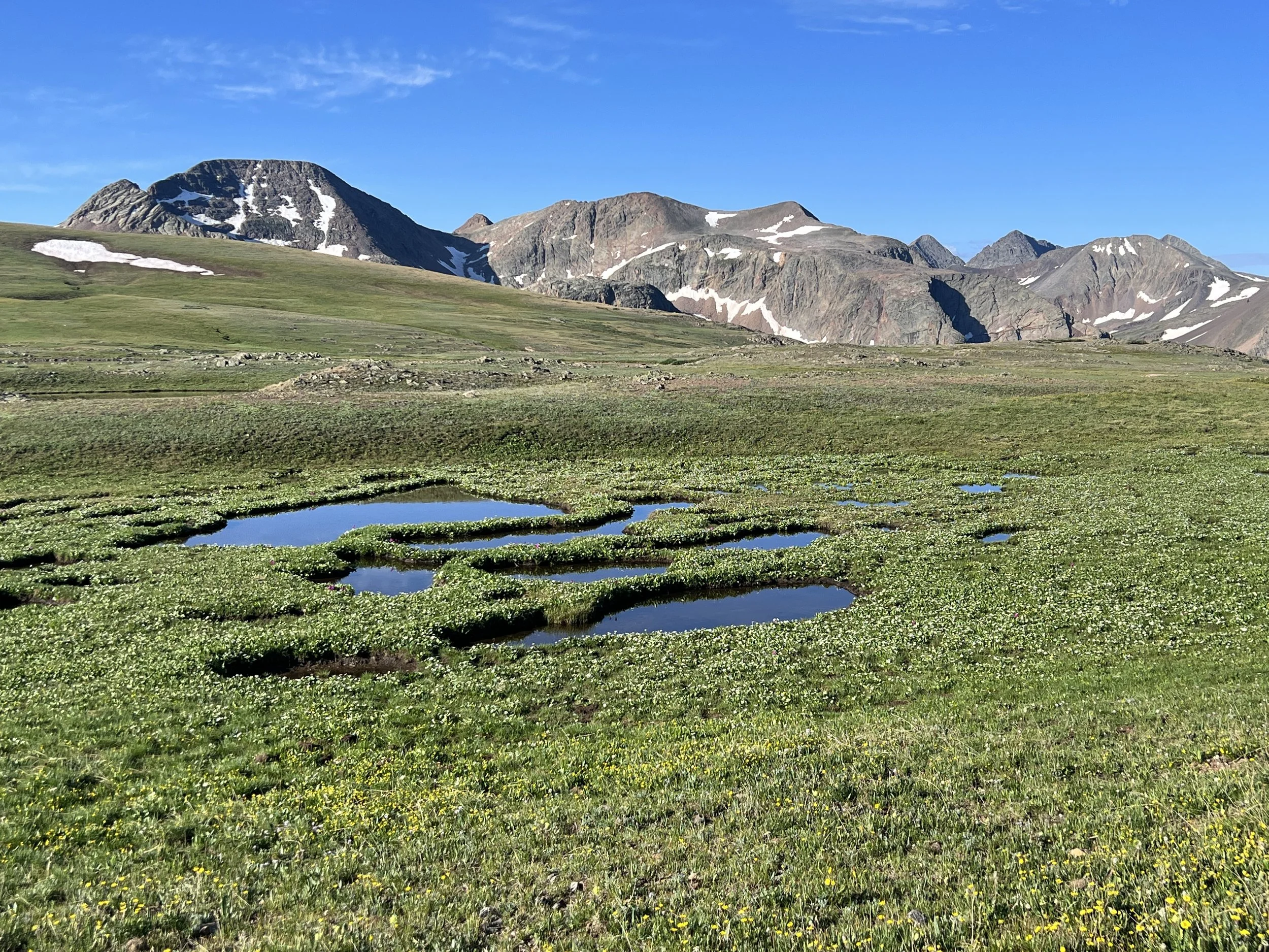
The next climb was slow and gradual and I passed a few people camped and a few springs as well. I ended up at the top of the knoll. It wasn't the prettiest camp spot in the world but it served its purpose. I guess I can’t ask for an epic view all 18 nights. Tomorrow should be an interesting day. I’ll have some ups and downs, and then a huge drop to Twin Lakes where I’ll walk around both lakes and then for the first time join the Collegiate West route. This is where the Collegiate East and the Collegiate West split on the Colorado Trail and hikers get to make a choice. Most choose the west as it stays higher and is more scenic. But lots choose the east as well. Many more are choosing the east this year because there’s still so much snow up high in the west. The CDT hikers coming through and north past me have reported no dangerous conditions so I’m definitely going west.

Water Everywhere
My goal tomorrow is either to camp on the approach to Hope Pass, on Hope Pass itself, or descending the backside of the pass just a bit. The pass is 29.7 miles from where I sit now. I plan to be up early as usual and think that I should be able to get where I want to get.
Day #7 - 7/17/23
Daily Miles - 31.65
Total Miles - 197.61
Daily Elevation Gained - 5,906 ft
Daily Elevation Lost - 5,433 ft
Calories Burned - 4,152
I slept well last night. It was in the high 50s when I woke up. Sleeping up high and away from water sure pays off in terms of warmer temperatures and dryer air. I started walking and, in no time, dropped down into tenting areas that were in the 30s. Today will be a bit of a roller coaster until the huge drop all the way down to Twin Lakes. I might stop for a bottle of juice and maybe some Skittles if I can find them. Otherwise, I’ll finish up that section and start the Collegiate West. This morning was beautiful, starting out in astronomical twilight, moving into nautical twilight, and just as nautical twilight changed the civil twilight I turned off my headlight. I didn't see any animals this morning but it was so very peaceful.
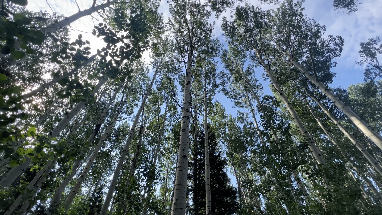
The drop down to Twin Lakes was beautiful as I was able to walk through two extremely large groves of Aspen. At the Twin Lakes split, I decided to continue on the CT and not go to the store. I’m not sure if it was a mistake in the long run but I didn’t really have enough water with me when I made the decision. About 3/4 of the way around the hot and sandy north side of Twin Lakes, I found a spot on the lake low enough to get to the water and filter. I sat in the shade and drank 2 liters of lake water. Not great water, but I covered it up with my electrolyte Nuun tablets. I saw nobody on the entire stretch around Twin Lakes until just after the dam when I met a CDT hiker. We chatted for a while and then I was off again with anticipation of the Collegiate West route. There were lots of storm clouds building, so the plan to hike over the pass might have to change. Just before starting the long climb up Hope Pass, I passed a woman with a dog coming towards me. She slowed long enough to raise her fist and say “Well done, keep it up.” I smiled at that accolade and continued walking.
Twin Lakes Approach

Twin Lake

Collegiate East/West Split

Aspen Grove

Climb to Hope Pass

Hope Pass
Day #8 - 7/18/23
Daily Miles - 28.18
Total Miles - 225.79
Daily Elevation Gained - 6,129 ft
Daily Elevation Lost - 5,469 ft
Calories Burned - 4,019
Amazing day yesterday. Hope Pass was spectacular and just as advertised. Because of impending thunderstorms, I decided not to stay on top and descend about 800 feet below on the south side. I found a nice little spot in the trees that later would prove to not be as flat as I thought. I didn’t get quite as much sleep as I had hoped.

Long shadows in the morning
The climb up to Hope Pass was gradual and not too hot, not too rocky, and not too hard, even though this climb had been touted by many as the hardest on the trail. Today, I’ll start with a big descent on the south side of Hope Pass and then climb up a valley towards the notorious Lake Ann and Lake Ann Pass. This one pass is still holding quite a bit of snow and hikers have called it “sketchy.” I’m not super-concerned. It should prove interesting, as there will be a ford of a creek towards the end of the day, and some debate about where to stay based on miles the next day. This section is called the “High 23” where you are encouraged to get through in one push and not camp on top per possible dangerous weather. Since there’s been no adverse weather thus far, I’m not sure if I’ll take that into consideration or not. More later.
Sun cresting
4.5 miles into the trail today…Trail magic! A couple former thru-hikers set up camp for two or three days and had all the fixin‘s for happiness. I had a couple small sodas, a bag of chips, some grapes, and even a mandarin orange. Quite a nice time sitting with them. I was the only one hanging out with them for the time I was there. They sit and wait for hikers throughout the day. Thanks guys!

Columbine
Later, I stopped at a lake and went swimming. I debated for awhile on the way up, but I never regret swimming, only missing the chance. I played leapfrog a couple times with a couple from Windsor, Colorado, Wren and Sundial. Ended up coming over the snow cornice on Lake Ann Pass with them and then met a trail maintainer at a junction. He talked to us about a sign he was putting up which designated the brand new Prospector Trail. This was a new section of the CDT and the CT. He said it was about the same length that stayed up high rather than going low and coming back up. All three of us decided to take it. We hiked for a couple miles chatting about various things and then I went on my way and said goodbye.
Lake Ann Pass Approach

Lake Ann Pass Snow Cornice

View from Lake Ann Pass
The Prospector Trail turned out to be something that felt very remote. In some places there was hardly a trail at all. The basins that it skirted were some of the prettiest I’ve seen so far. I was very lucky to have passed that man at the time he was there. With that said, the trail completely disappeared in the third Cirque. I spent about 45 minutes looking and finally just followed the contours of the geography dropping in elevation. A bit later I found the rough trail.
Around mile 15 I twisted my right ankle and took a little break. I tied my laces tighter and planned to be more careful. As I started walking again, I could barely feel the twist. Hopefully all that PT I’ve done over the last 6 months has made my ankle stronger in terms of recovering from injuries. Only time will tell.
My ankle did pretty well on the downhill, but I got a little frustrated with the trail maintainer who suggested this route. It reminded me of an unmaintained use trail in the Sierras. You could tell they built it over the last few years and a lot of it was starting to grow back over. Nature wanted the trail back. I’m not sure what the mileage difference actually was as it’s hard to tell with my app and my mapping, but the physical and mental toll that that 7 miles took on me, slowed my pace to a crawl and beat me down a bit. It ended with two fords of two different creeks. I chose to walk through in my shoes without my socks or my insoles. I sat next to Texas Creek and had dinner while my boots drip-dried. I was unsure of where I’d end up for the night. I chose to just start walking and see where I ended up.

Cottonwood Pass Road Crossing after Sunset

Last mile on the trail at about 9pm
Day #9- 7/19/23
Daily Miles - 30.97
Total Miles - 256.76
Daily Elevation Gained - 6,319 ft
Daily Elevation Lost - 7,152 ft
Calories Burned - 4,929
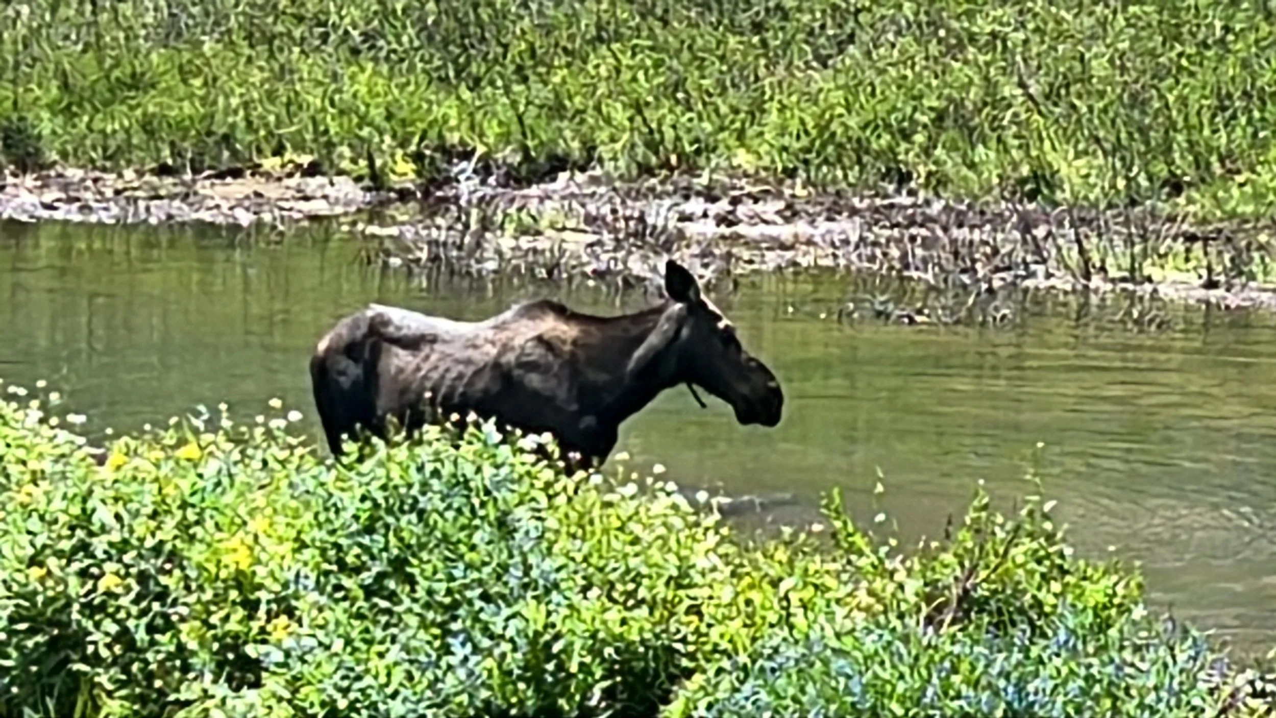
Last night, I ended up going a little further than I thought I would. I got to see a moose a couple of miles before Cottonwood Pass. After making my way to the top of the pass, I crossed the highway and walked another 1.7 miles. I camped above 12,000 feet under a very cloudy sky. I set up my tarp and snuggled in and listened on and off all night to raindrops on the tarp. By the time I got up in the morning, my tarp was dry from the wind and I was ready to hit the High 23.

Moooooose!
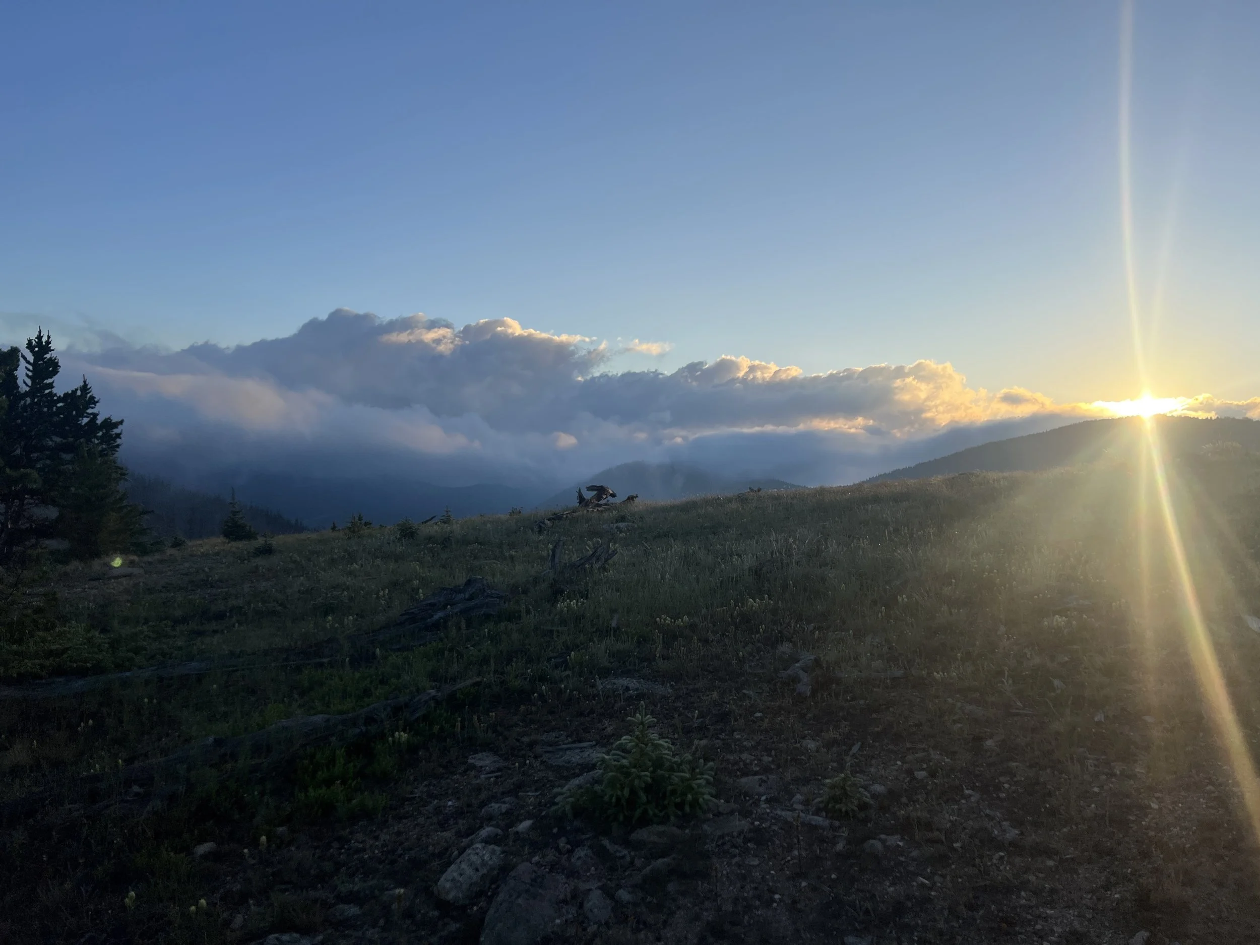
I started walking by headlight and about 30 minutes before the sun rose, I came to a section of the trail with a stunning view of the sun making its way towards the horizon. I spent about an hour eating, drinking and taking pictures. It would end up being the best breakfast spot of the entire trip.

Sunrise and setting up for breakfast

Best breakfast spot of the trip

Walking a ridge at sunrise
It was an amazing morning of animals and more views. About midday, I came down about a thousand feet to a creek and took a dirt nap. I woke up to a woman running towards me with a dog. As she ran by, I stopped her and said, “Didn’t I see you the other day?” Turns out, she was on a trail at Twin Lakes the day before yesterday. Twin Lakes is a long way from here. She and I talked for a long time, as she’s an ultramarathoner and is getting ready to run the Lonely 100. We talked about long distance hiking and running ultras. She told me I should be an ultramarathoner. Hmmmm… We parted ways, each going the opposite direction.

Collegiate Range
Later, I hiked with Lizzie, who is hiking the Collegiate Loop, meaning she is hiking both sides of the CT in the Collegiate Range and making a loop of it. She works in the Outdoor Ed program at Mesa University in Grand Junction. She was very interesting to talk to. I kept a nice slow pace up to the first pass, and then said goodbye to her and went off on my own.
Landscape
For the first time today, I took the wrong trail. It was only about a half-mile either way, but the worst part was that it was on a rocky four-wheel-drive road with water cascading down from the top. It was the last 3/4 of a mile from my planned dinner spot, and I think I was just out of it.
Wong Trail of Rocks and Water
Day #10- 7/20/23
Daily Miles - 11.51
Total Miles - 268.27
Daily Elevation Gained - 3,024 ft
Daily Elevation Lost - 2,544 ft
Calories Burned - 1,387
I had to stop recording last night's journal and pictures because dinner was a frenzy trying to feed myself and charge my electronics. While trying to get it all done I realized that my external battery pack was completely dead. I have no idea how it went so fast in five days but I will most probably have to get a second smaller one in town later today. Last night was a bit of a blur. It was getting darker and darker and raindrops were starting to fall. I had to make my way through one huge decades-old rock slide after another. In addition, there were mosquitoes, the worst they’ve been on the entire trip, and I had to make my way around a couple different small, boggy lakes. I saw no animals. I set up camp in haste at a trail junction so that I would make sure to know where I was going in the morning.

Boss Lake
About 11:00 pm, some small animal started battling me. Because my headlight was dead and I didn’t want to chance turning my phone on too much, I never got a good look at what it was. I finally gave up around 1:00 am and I slept. I had no alarm and no way of waking up since my watch died the day before. Miraculously, I woke up as astrological twilight turned to nautical twilight. I got packed up without much care for some damp gear. I’d be able to dry everything on my time off the trail with Lenore and Dusty at the hotel tonight. I probably won’t get a lot of pictures today because I’m gonna have to keep my phone off to conserve battery over this 12 miles. Oh yeah, I was able to knock out an extra 5 miles last night in my stupor, so I only have 12 to do today to get to Monarch. More later.

Sky Pilots
The 12 miles came pretty easily. I had to climb up and over Monarch Mountain on a fire road before I hit Highway 50 and the Monarch Crest store. The store has been there for decades, but is under new ownership and has a new focus on hikers. They’ve got just about everything a hiker could want or need.

Approach to Monarch
I headed to the cafe and ordered a Black Bean Burger and full order of fries and then proceeded to completely devour it. When done, I got an interesting hitch from a family from Missouri taking their annual summer trip to Colorado as they drove me to the Monarch Mountain Lodge, where I was to meet Lenore and Dusty. The lodge was a ghost town heavily used in the winter, but seldomly used in the summer. They had no employees on site in the daytime except for one woman cleaning rooms.

Lunch
When I was 16 years old, I lived in Colorado Springs for the summer. One weekend I stayed in this very hotel with my sister. I remembered walking around the hotel, almost 40 years ago, and finding treasures at every turn.
I walked past the empty front desk, past some other hikers prepared to wait the 2.5 hours till someone showed up to check them in. I headed to the elevator and took it down to the 1st floor. There, I found what I was looking for. The pool, the locker room and the showers. They were exactly as I remembered. Frozen in time.
First, I used the locker room to unpack my backpack and spread out all of my gear. I dried damp gear, and cleaned things that needed cleaning. Then it was into the showers for one of the longest showers of my life at maybe 25 minutes. Now clean, I headed to the pool and swam in my clean underwear for about 30 minutes before heading back into the shower to get the chlorine off and even more clean.
Later, Lenore and Dusty showed up and I immediately put all of my dirty clothing into the washer. While waiting for the laundry to be done I swam one more time and followed it up by one more shower. We checked into our rooms and I spent another block of time going through my food box and Bounce Box getting everything organized for the next section of hiking time.
Once done, we headed to Salida for an amazing Mexican meal and a quick stop at Walmart before coming back to the hotel and visiting for a good long time. So nice to be able to spend so much time with them this summer. Back in my room sorting out my things for tomorrow. One last shower before bed and before hitting the trail in the morning.
Sleeping in bed is nice. Sleeping under the stars is epic.
Day #11- 7/21/23
Daily Miles - 34.43
Total Miles - 303.70
Daily Elevation Gained - 5,436 ft
Daily Elevation Lost - 5,446 ft
Calories Burned - 3873
Great night sleep at the Monarch Mountain Lodge. I took care of myself and am feeling like a bit of a new guy today. I’ve got a clean body, clean clothes and I’m nourished and rested. I’m feeling good for the second half of the trip which begins right now.
Morning out of Monarch

Early morning trail
I got a quick turnaround to see Lenore and Dusty one more time with a light load of food and a full pizza in my pack from Salida last night. One more resupply outside Lake City before my final push to Durango.
Wildfowers
My first pair of new shoes blew out days before Monarch and I switched them out with older backup shoes I’d placed in the Bounce Box. I chose to put the original Altra shoe insoles back in a second pair of boots and the cushioning feels wonderful thus far today. I think I’ll only use the manufacturer insoles for Altra for now on. I had tried something else (Dr Scholl's Gel Insoles) but they appeared to be completely collapsed and compressed halfway through the hike. Back to the insoles that came with the shoes. (This would prove to be one the biggest mistakes of the trip…one that came close to ending my trip early).

Trail sign
I was passed by four motorcycles early this morning which was kind of odd as I’m not used to hiking on trails that allow motorized vehicles. Later, a group of 9 or 10 mountain bikers passed me and then still later another couple of other mountain bikers later. The bike packers heading south on the CT are starting to catch me.
I also hiked past Marshall Pass today which was kind of surreal for me. Twenty years ago, I planned to hike half of the CT starting at Marshall Pass and ending in Durango. This part of the trail was so very uninspiring, that I decided to quit after 100 miles and hitchhike back to my sister’s house instead.

Marshal Pass
I caught up to a Colorado Trail crew about noon. One of the crewmembers offered me some amazing homemade cookie balls. I was able to talk with the crew leader Tom for quite a long time about the Pioneer Gulch debacle the other day. He heard a bit about it, but not much. He took long, copious notes to tell Darren who is the head of the CT. He also encouraged me to call Darren myself from Lake City when I got there. I’ll do that as well. It was fun to talk to the entire crew. I wish I would’ve had time to stop and help a bit. Tom gave me his talking points about joining a crew someday and helping out. I’d love to do that. Maybe some summer I can plan a trip out to see family and at the same time join a trail crew.

Trail Crew
I played leapfrog today with a couple mountain bikers from Washington for a long time. They have to spend so much time walking their bikes that I’m going faster than them a lot of the time. I’m still feeling great at about 25 miles for the day. Looking forward to seeing how far I can get today.
Blinding sunset walk…
Day #12- 7/22/23
Daily Miles - 38.46
Total Miles - 342.16
Daily Elevation Gained - 5,177 ft
Daily Elevation Lost - 6,220 ft
Calories Burned - 4,224
Walked almost 35 miles last night. Finally found a clearing and then collapsed into a heap. I set up camp and was asleep in no time at all. Woke up this morning and everything was covered in dew. My sleeping bag, my bivy, and everything that was out was soaking wet. My goal is to get packed up as quickly as possible and try to stay dry, and wait until the sun rose to find a place to try everything out. This was the first night that I’d had to deal with any kind of condensation. I've been lucky thus far. As I started walking, I noticed that both feet felt like they were developing hot spots (the precursors to blisters).
I stopped a while later and put some Leukotape on the hot spots. This is tape used by medical professionals and hikers alike. Unlike other tape, it just won’t come off by itself. It sticks amazingly well.
The hotspots may have formed when I switched my boots and insoles in Monarch. Because my feet were so sore coming into Monarch, I’d switched out my insoles. I thought that I had broken them down and that I should use the Altras instead. I think the change was a mistake. At this point, I think the Altra insoles have given me two blisters on each foot in the same place. One right on the bottom of the heel, and one in at the ball of the foot. They’ve gotten more painful as the miles have gone by.
My morning was spent walking, slowly, listening to cows mooing, elk bugling, and woodpeckers pecking, all mixed in with the sounds of birds waking up to a new day.
About 11 miles in today I found some amazing trail magic. I met a bunch of women who met years ago in Kansas City. They have all been thru-hikers in the past and present, and stayed friends all these years. They have set up a camp spot for a week in the lowlands where water is scarce. They were making pancakes. Yes, pancakes.
Trail Magic Signs

All you could eat pancakes
They had as much water as hikers could drink and chairs to hang out in. I met a few lovely people. One was Balloon, who spent most of her life in Germany, and is now living in Colorado. I ended up leaving with her and we walked together until early evening. Our paces were very similar and we had great conversation. She stopped once we finally reached some reliable water for the first time in many hot and dusty miles. We said our goodbyes and I hiked on.

The Kansas Crew’s Set up
My hope was to get 36 or 37 miles that night as to have fewer to hike the next day at Lake City. My plan was to hike for a couple hours and then take a break and then hike for a couple hours and then take a break and see how far I got. My wife had been able to score me a room for the next night in Lake City and I really wanted to get there to rest my feet and assess how they were really holding up.
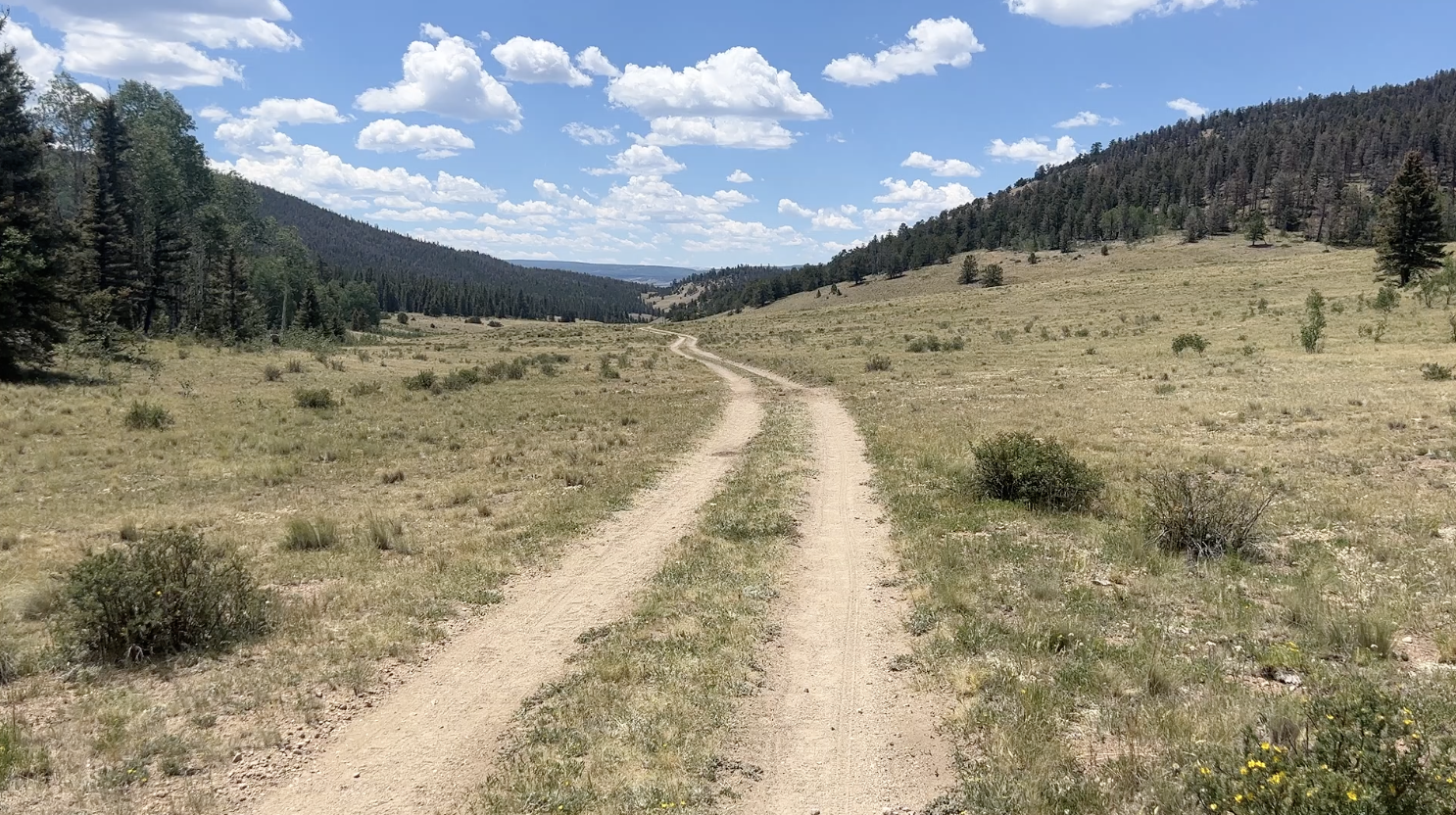
Miles of dry hot road walks in this section
The one crux, two actually, was that 6 miles from where I restarted was another wet water crossing. Meaning that I’d have to either walk through in my shoes and get them wet or take my shoes off. Neither option sounded great with all these blisters. The other crux was that it was basically all uphill from where I was to Lake City. Should be an interesting evening and I will probably have to finish writing tomorrow about how today ends.
At 10:30 at night I forged Cochetopa Creek. I decided to use my old socks and no shoes. It was cold and painful and it’s over. I’m back on the trail.
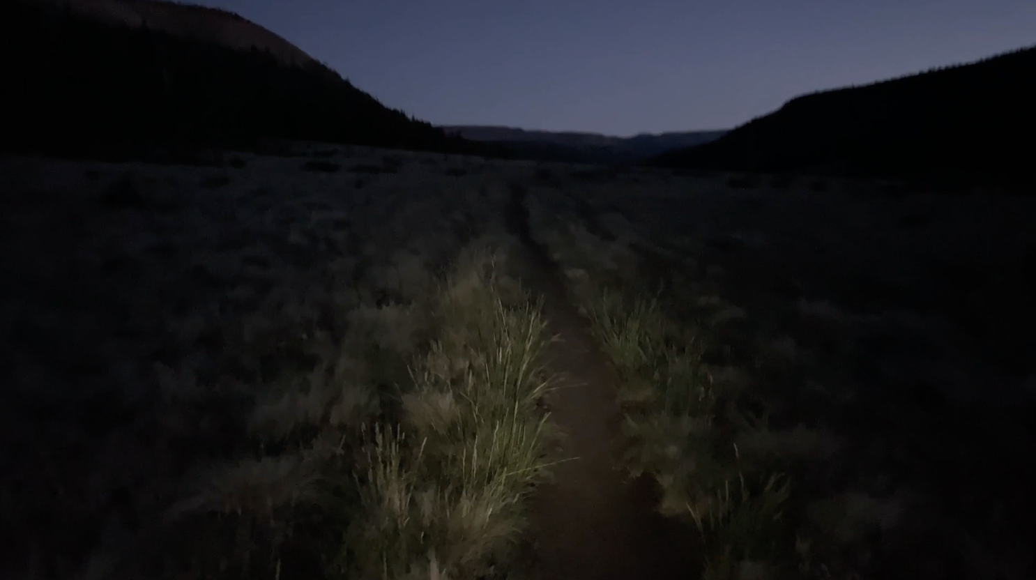
Night hiking
Day #13 - 7/23/23
Daily Miles - 28.05
Total Miles - 370.21
Daily Elevation Gained - 6,024 ft
Daily Elevation Lost - 5,472 ft
Calories Burned - 4,154
A HUGE day of nearly 39 miles last night.
At 12:30am, I decided to take a dirt nap. Meaning, I just laid out my ⅛ inch thick Gossamer Gear Thinlight Pad and tried to get some sleep. I got a little cold, so I pulled out my sleeping bag. I slept on and off for about an hour and a half. At 3:00 am I was back on the trail. Walking by the light of my headlight in the cold on the edge of a side hill of the Cochetopa Creek was a bit sketchy until the sun came out, and as I climbed San Luis Pass, everything changed. On the pass, I made coffee and had some breakfast and hung out for a while. As I was leaving, a man on a day hike with a group of women stopped to talk to me. Joey spent his summers in Creede and was touting Lake City and the store his sister Tracy owned. We talked for a while about hiking and parted ways.
The second big rest I took was 14.7 miles before the road to Lake City. And after the rest I started jogging all of the downhills. Jogging softened the blow to my body and to my blisters so I continued to jog all of the flats and downhills while I walked all of the up hills.
Once the sun came up walking was easier
Not long after as I was crossing a valley, I saw a mother moose and a calf. They were eating in a pond and looking very serene. The trail continued rising in elevation and stayed up around 12,000 feet for miles. This was a bit unexpected, as I thought I’d be a bit lower on this day.
Moooooose!
The last couple passes before Lake City

Columbine in all its glory

Interesting geology just before Lake City
Long flat walks before the final rocky one-mile drop to the highway
Late in the day, another thru-hiker caught me for the first time. We hiked together on and off till Spring Creek Pass where we were able to get a hitch into Lake City. The man driving was from Texas, but spent summers in Lake City and told us that the church had a weekly 6:30 pm dinner for the whole community and that all the hikers in town were welcome. He drove straight there. It was a potluck affair with a little bit of this in a little bit of that. I sat with a group of hikers and chatted for a while, and then later chatted with a 93 year old woman who lives in Texas, but spends her summers in Colorado as well. When finished, I walked to the Matterhorn Hotel and got checked into my room. From there, I worked on my feet a bit in terms of trying to decide how to proceed. Then I went to the Packer Saloon for a filling second dinner of pasta and salad. I came back to the motel and cleaned some things up in preparation for Lenore and Dusty showing up the following day. They would be helping me get my food sorted out and my laundry complete and they were kind enough to offer to stop at Walmart prior to coming to see me, with some new socks and some new insoles, which will hopefully get me to Durango. My feet at this point were so bad that walking without shoes was impossible. Taking a shower was extremely difficult and I had to hold onto the wall with one hand to take enough pressure off my feet to try to get clean. With my feet being as bad as they now were, I was starting to worry about the remainder of my hike.
Day #14- 7/24/23
Daily Miles - 9.64
Total Miles - 379.85
Daily Elevation Gained - 1,900 ft
Daily Elevation Lost - 906 ft
Calories Burned - 1,451
I had a wonderful night's sleep last night. I worked on my blisters for a bit before sleeping but they feel about the same. Can’t walk at all barefoot but I put on boots and I can muster. Hoping some new insoles and socks coming with Lenore and Dusty will really do the job. With 6 days and 129 miles left, the math comes out to only about 21.5 miles a day. Far less than I’ve been doing.
Great breakfast at Chillin today. Huge Texas Toast Grilled Cheese with an egg and a mocha to accompany it both hit the spot. The word is that daily thunderstorms will start today. The rest of the CT should be interesting with some weather mixed in.
Had a nice lunch with Lenore and Dusty at the same place that I had dinner the night before. We got to visit a little bit and catch up. So nice having them be able to help me on this adventure. It’s been wonderful. They dropped me off at the trail at 12:15 pm, the same time as the hiker shuttle and two or three other cars of hikers were dropped off. I hit the trail right away, wanting to get ahead of the bubble of hikers. I was wearing new socks with new insoles and my feet were pretty tender. My backpack was 8 to 10 pounds heavier than it was coming into town, so I had to just play it by ear to see if I wanted to continue wearing the new socks or flip back to the pair of old socks. I also brought my old insoles just in case. The weather was changing. Thunderstorms were expected every day from now until I finished. Just minutes after I hit the trail, I heard some thunder booming to my east and saw a rain cloud dumping its load. I’d have to keep an eye on the weather today, as the trail will go over the high point of the Colorado Trail later. In addition, it’s above the tree line from mile 8.7 to about mile 21. Meaning there’s no safe places to camp between the two. I guessed that the entire bubble that started at the same time today would all hike to 8.7 and camp there. I wanted to go further, but weather would be the determining factor.
Me and my sis.
Well, Mother Nature had plans of her own. The thunder and lightning started about mile 6.5 and followed me all the way to camp at about mile 9. On the way, I had to put on my pack-cover and my rain gear. After another mile or so, I pulled out my umbrella. The umbrella worked quite well, using it instead of raingear may be a better choice going forward. It all depends on how windy it is, as the umbrella is useless in the wind.

Rainstorms all around me
I set up camp quickly and I hopped inside my tarp. I made some dinner in the entryway to my shelter and got my food situated for the next day, as I like to do each night before. Because I only hiked 9 miles today, I’ll need to hike about 23 miles a day over the next five days. I mapped out approximately where I want to stay each night and it will just depend on the weather as each day progresses. I set my alarm for 4:30 am so that I could get started nice and early. Hopefully the sky will be clear and I can get going when I awake.

Rainstorms all around me
Day #15- 7/25/23
Daily Miles - 27.90
Total Miles - 407.75
Daily Elevation Gained - 6,286 ft
Daily Elevation Lost - 5,659 ft
Calories Burned - 4,463
Well, I got in my tarp last night at 5 o’clock and didn’t get out again until the morning. It rained on and off most of the night, but by morning almost everything was dried out from a slight breeze. I’d be entering the high country again today, and passing over the highest point on the Colorado Trail at 13,334 ft. Walking is very painful. I’ve got blisters on both feet in various places. No matter what I try to do to mitigate the pain, it’s really with me every step. I’m doing the best I can to try to put it out of my mind and focus on the beauty around me. A couple of other hikers made their way out to the trail as early as I did this morning and passed me early on. I was moving pretty slowly but, with only about 24 miles a day, things should work out.

Sunrise walk

Soft light

Vast valleys

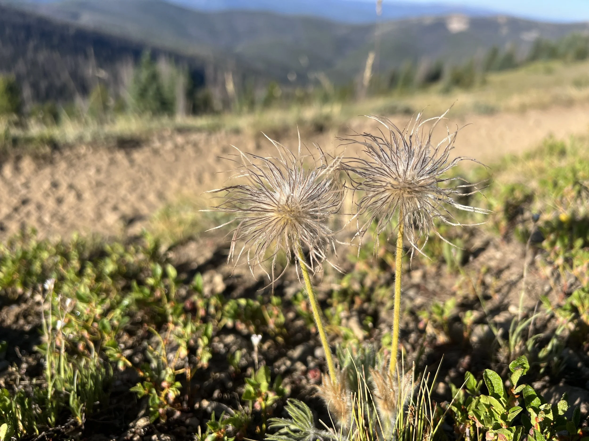
Wildflower fun
High points and some low points today. My feet hurt really bad all morning long. But after about six hours of hiking, the feet went from unbearable to just plain painful.

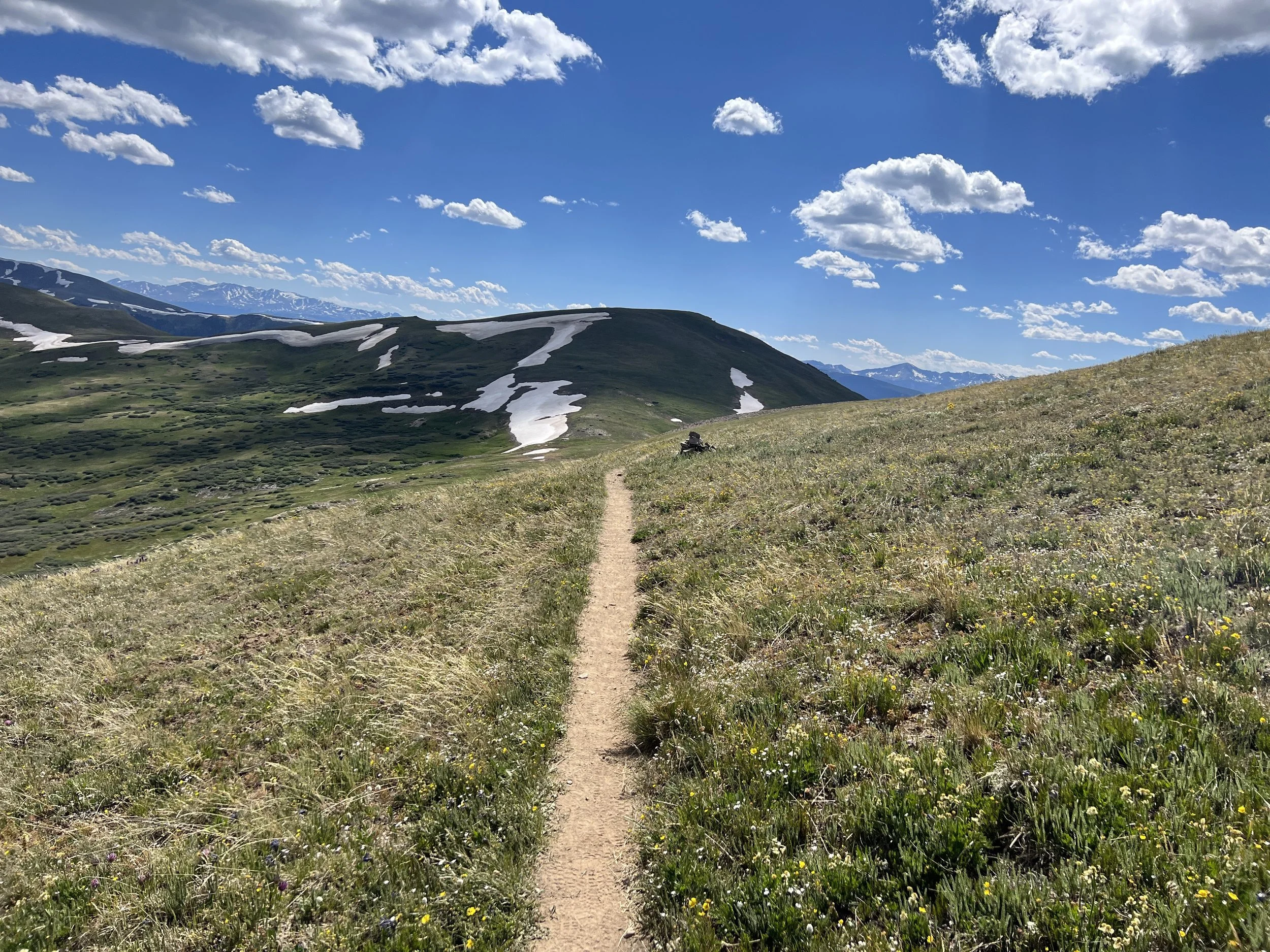
High point of the 486 miles
Picas, marmots and chipmunks met me around the corner as I walked today. It was comical how many there were and that they seemed to be saying hello and goodbye to me constantly throughout the day.

Columbine everywhere
It turned into a very nice day and I did almost 28 miles. I camped on a bluff with a view of Arrow and Vestal peaks, as I’d wanted to since before the hike. I got my feet elevated before bed and was aiming for a good night's sleep. Tomorrow would hopefully be a good one.
Another Wilderness area
Day #16- 7/26/23
Daily Miles - 26.19
Total Miles - 433.94
Daily Elevation Gained - 4,396 ft
Daily Elevation Lost - 5,633 ft
Calories Burned - 3,424
Amazing night’s sleep in an amazing camp spot. Best camp spot of the trip and I slept in and watched the sunrise over beautiful peaks in the rest of the San Juan range with coffee made from still inside my sleeping bag. After a bit of breakfast, it was time to head off. I was amazed at how much better my feet were than the last few days. Not sure what the difference was but they were much better. Today would involve a huge drop of 3000 feet to the Animas River (dropping below 9000 feet for the first time in ages), and then a climb back up to about the same altitude. My goal was to do 25 miles each of the next three days and then have only about 15 miles left for my final day. The other treat for the day is that there is supposedly a snack bar 15 miles into my hike. It would be a good place to get rid of trash and possibly get a soda or a snack. I was looking forward to a great day.

Best camp spot of the trip

Arrow and Vestal Peaks
Met a hiker from the Santa Fe Forestry Recreation Department and had a nice chat. Later, I took a wrong turn for only the second time in 400 miles. I guess that’s not bad? The CDT diverged from the CT, and I went the wrong way. I only went about a quarter of a mile and ironically saw the best field of wildflowers I’d seen yet.

Leaving the CDT for the rest of the tip
Lush
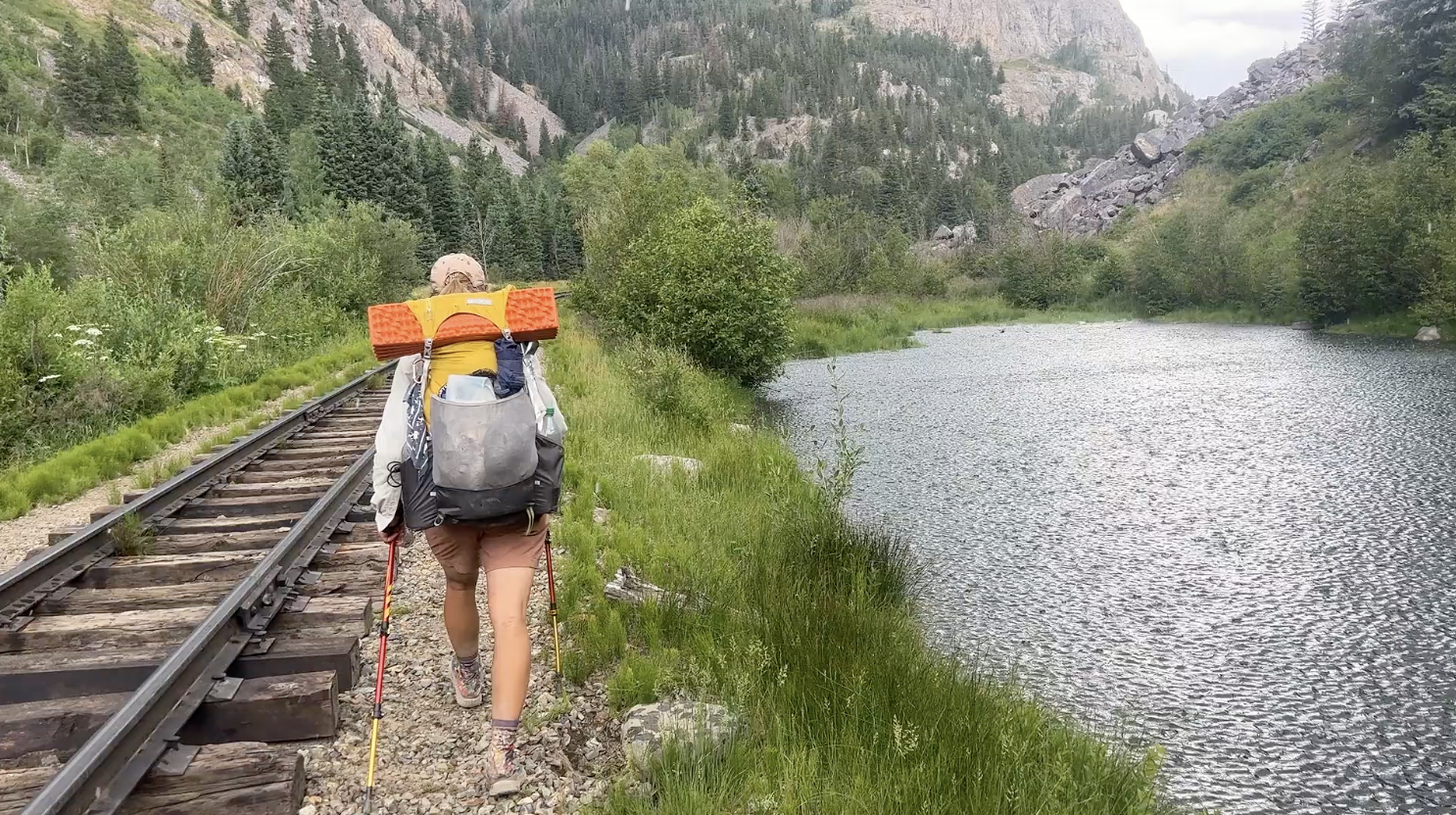
Another 15 minutes later, I saw a hiker ahead of me and wondered who it could be. As I got closer, it looked like it might be Balloon and the closer I got the more sure I was that it was Balloon. I had caught up to her or rather, she had caught up to me? We hiked together for the next four hours. It was great getting caught up with her since the last time we had hiked together. At the Animas River we got hit by a thunderstorm that went from rain to hail in seconds. By the time we got our rain gear on we were drenched. We continued to the Molas Lake Trailhead where we said our goodbyes. I would try to hitch the 1 mile to a snack bar I’d been dreaming about and she would go on to hike another mile to the road to Silverton, where she would take a day off of the trail.
Balloon as the storm broke on us
I gave myself 20 minutes on the road to get a hitch and 16 minutes in, a sweet couple walked across the street who were camping in their RV. They asked me what I was doing and where I was going and they were fascinated. They walked away, and I continued to hitch. Not a minute later they walked back and told me they had some snacks in their RV and asked if I would like some. Yes! So, the hitch to Molas would not happen, but I got some yummys from some nice people. Tana and Tom gave me seven scrumptious, frozen peanut butter balls and three Mandarins. I decided to call that Trail Magic and, instead of hitching, had a small conversation with them before heading back to the trail. Tana and Tom were from Grand Junction and were truly a gift from above. Another example of the saying, “The trail provides.”

After the storm

Sheep blocking the trail

Last light and a wonderful camp spot
Day #17- 7/27/23
Daily Miles - 26.61
Total Miles - 460.55
Daily Elevation Gained - 4,462 ft
Daily Elevation Lost - 4,967 ft
Calories Burned - 3,263
Last night, I ended up walking a bit farther than planned to find a decent camp spot. I did my chores and hit the sack. I awoke at 4:57 am to raindrops. My tarp was not over me. In less than a minute I had it up and was also wide awake. It was only about 30 minutes before my planned time to get up. I made some coffee and started slowly packing up. The drizzle continued on and off till I was all packed up.

Morning walk
Many waterfalls today
I really enjoyed my walk all morning. It was a big climb, about 1000 feet, which was well graded and free of rocks for the most part. The most inspiring aspect of my morning was the sky and the ground around me. The sky turned different colors constantly as the sun made its way over the horizon. The wildflowers woke up with the changing sun and changed color along with the sky. It was a truly beautiful and fascinating performance.
Flowers greeting me as I walk
Later, I encountered a bunch of deer going over an unnamed pass. A marmot was running figure eights around the 8-10 deer. My body felt good and I was really focusing on my pace, with my feet and my knees at the forefront of my mind. My gut wanted to do around 30 miles a day or more, but my brain was telling me to walk a bit more slowly and take a little more care to finish off healthy.

Deer on Blackhawk Pass
Met a couple middle-aged folks out on the Razor from Durango for the day. Out from Durango for the day? It was getting real. I was almost done.
Wonderful afternoon. Great hiking conditions. It threatened rain all day long but it didn’t show up until late and only for about 10 minutes. Earlier, it looked very threatening and I raced up and over Blackhawk Pass before making it safely to the southern side. At the top, I found Al, the mountain biker I had met days before. We had a nice chat.
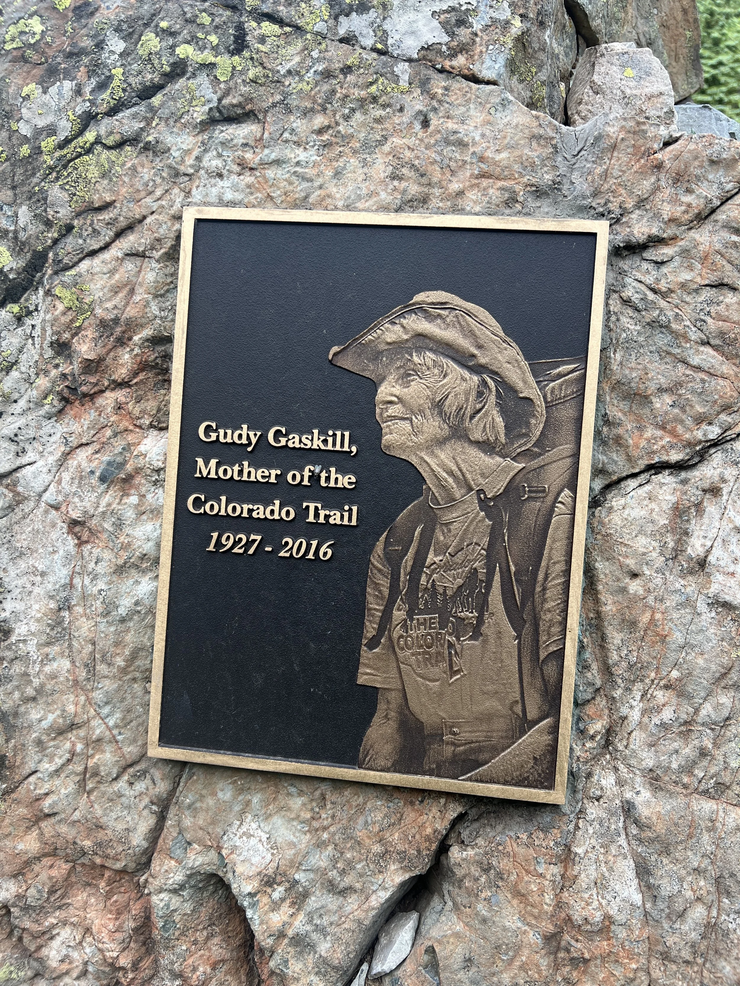
Gudy….
I walked through a 14.1-mile section during the morning with no water. The day was warming up to feel like one of the hottest days on the trail. Luckily, I got an early start in the cool morning, and the trail weaved in and out of the canyon shade.
Met a couple of bikepackers today from Guadalajara, Mexico. They were planning on finishing up in 15 days. Thought they might finish 14 instead. Nice guys to talk to. They were amazed it was only going to take me 19 days.
The trail was very well-groomed and graded today. I really enjoyed the day in and out of the healthy forest. After being in beetle-infested forest for the past three days and seeing hundreds of thousands of dead trees, it was nice to be in a healthy forest once more.
The geology really changed today as well. I moved into much more southwestern red rock and it was beautiful. I found a camp spot on a ridge and was able to watch storms in almost every direction. My tarp was up and I was ready for a rainy night. Second to last night on the CT. How can it be…?
Day #18- 7/28/23
Daily Miles - 27.32
Total Miles - 487.87
Daily Elevation Gained - 4,147 ft
Daily Elevation Lost - 5,794 ft
Calories Burned - 3,072
Wonderful camp spot last night. Watched the colors change in the sky all the way until it got dark. It never ended up raining on me. Spent the morning walking on a soft and mostly level trail. I stopped on a rock with a view to the south for breakfast, savoring every moment that I had left on the trail. There was no water for 8.1 miles after breakfast, but I had about a liter and a half and was fine. It was a nice, cool morning in the forest.

Wonderful camp spot

Breakfast time
I felt so good all morning that I decided to take a break for a swim and early dinner at Taylor Lake. It was a shallow lake and a nice break. I swam, ate and let my clothes dry in the sun. Once I got started again, for some reason my body just didn’t want to cooperate. I was lethargic and slow with only about 23 miles left in the hike.
I kept walking, as I wanted to only have about 15 miles left for the last day. Paula and Isabela had told me they would meet me at 1:00 pm and I wanted to time my finish as close as I could to that. I crossed a bridge where three middle aged men were camped. Maybe it was because I was tired, but they creeped me out a bit. I kept hiking, and the trail rose high above the creek bed I’d been following. It finally rose above the rim of the canyon on the other side. At about 6:30 pm, I found a nice little flat spot with a view of the eastern sky. My hope was to see the meteor showers that both coincided on that night with the best views between 12:00 am and 2:00 am. On my birthday. One more day on the CT. I only had about 13 miles left to the trailhead. I planned to sleep in and then take it nice and slowly. I was so excited to see Isabela and Paula.

A visitor

Dropping off of the last big climb

Knife edge of scree
Taylor Lake
Day #19- 7/29/23
Daily Miles - 13.89
Total Miles - 501.76
Daily Elevation Gained - 925 ft
Daily Elevation Lost - 2,815 ft
Calories Burned - 1,487
My last wake up on the Colorado Trail. Last breakfast. Last pack up. I got a decent night's sleep last night. I set my alarm for just after midnight for the meteor shower. Ended up seeing five meteors over about an hour. Five is my lucky number since I just turned 55. Packing up slowly this morning and watching the colors of the sky change as the sun got closer to the horizon. The chipmunks around me were waking up along with all kinds of birds. It looked like it was going to be a beautiful morning.
Waterfalls
Lushness
Unlike other long-distance trails that I have completed, the day was filled with congratulations from passersby. Those on horses, those on bikes, and those on foot, all asking if I was finishing up the entire CT. When I said yes, they were all filled with congratulatory remarks. It was a very satisfying, enjoyable way to end thru-hike.

Durango-bound
I took a long break at Gudy’s Rest. Gudy Gaskill, creator of the Colorado Trail in the 1970s, made this all possible. As I sat, many people stopped by and talked. One local from Durango gave me some good restaurant intel and two other ladies not only shared some terrific conversation, but they also shared some homemade dried apricots, some tortilla chips and a peanut butter chocolate chip cookie. People are very kind. Three miles left till I see my two loves.
Last of the aspen

Me atop Gudy’s Rest
The last few miles were beautiful. The hike started in a canyon near Denver and ended in a canyon near Durango. Very fitting.
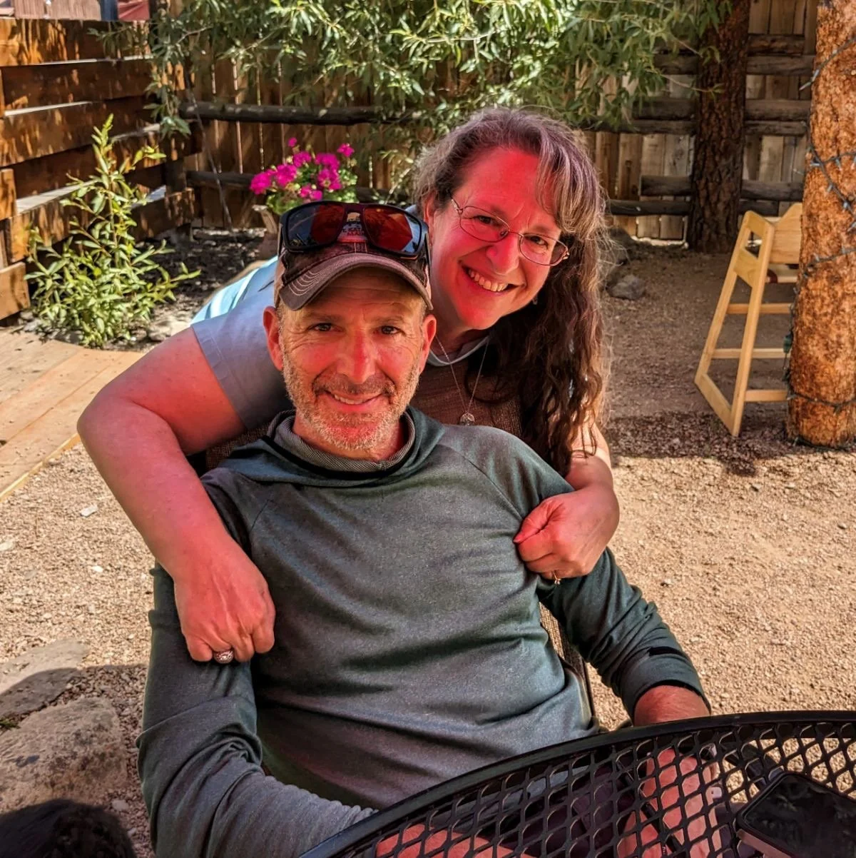
About 50 yards from seeing the CT terminus sign, I saw my beautiful daughter running towards me with a sign she’d made congratulating “Dreamer” for his CT completion. Around another corner was my beautiful wife videoing me taking my final steps. It was hugs, kisses and pictures followed by half of a leftover burrito in the car on the way to town.
The trip ended with showers, food, rest, and many repeats of all of those. It was odd, exciting, amazing, and a bit sad as well to be back in the frontcountry. With that being said, I now know that my body and mind can still perform in the way I desire in the backcountry. I know that I still have the skills, the knowledge and the confidence to pick any trail that I’m interested in hiking and plan and prepare for a successful journey.
What’s more, is that I have renewed confidence in myself in terms of sharing my experiences and wisdom with others in my new company called Alpine Adventure Coaching. I’m beyond thrilled to dive into this new chapter of my life and combine my passion for education with my passion for long distance backpacking. Exciting things are ahead of me. And will I be hiking other long trails in the future? Of course I will.
I’ll hike as long as my body allows me to hike.

Celebration!

Double Nickel
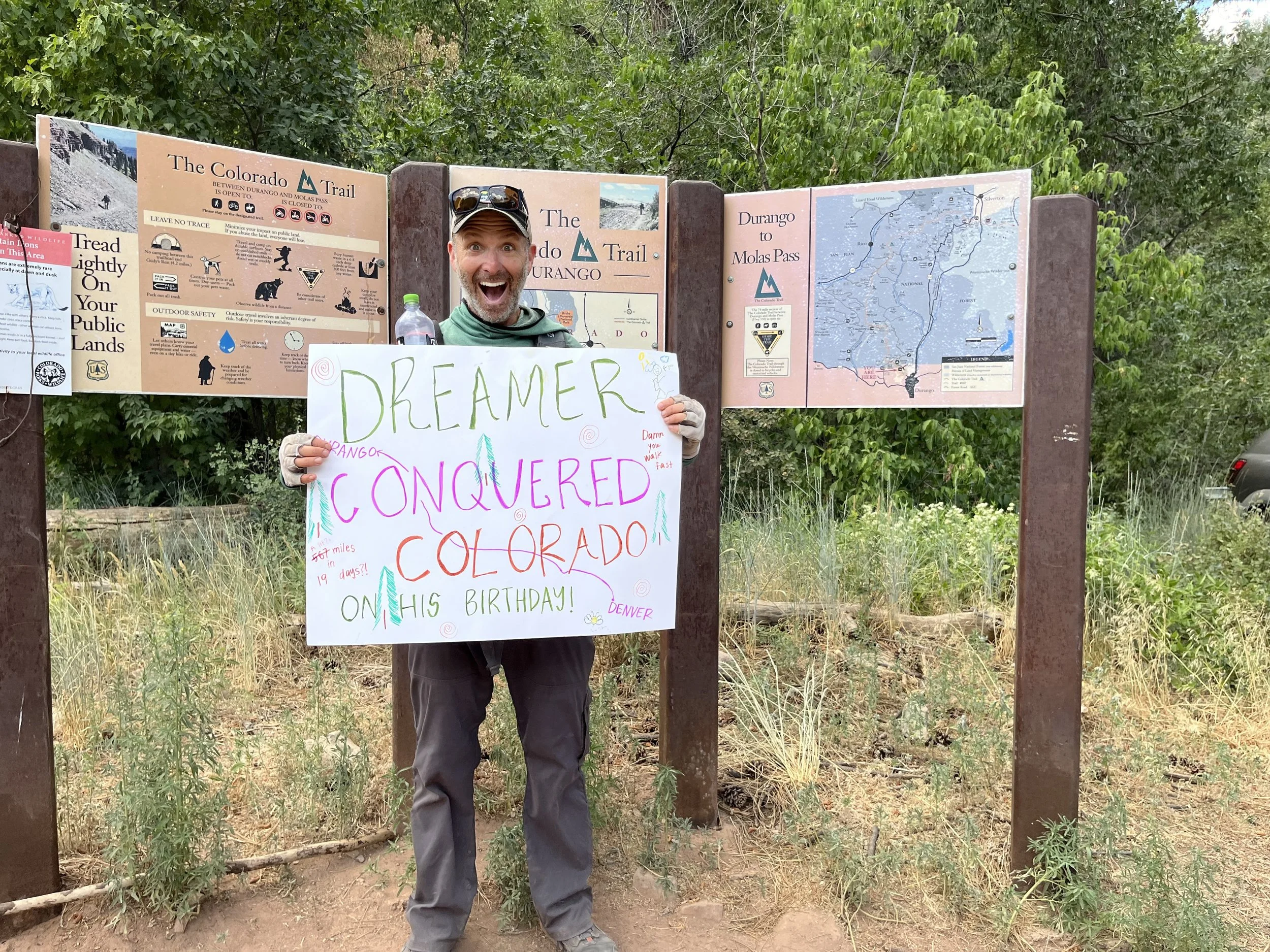
“Conquered” ;)